Freiwillige Feuerwehr Amberg
Freiwillige Feuerwehr Amberg is a fire station in Amberg, Upper Palatinate, Bavaria. Freiwillige Feuerwehr Amberg is situated nearby to the motorhome stopover Wohnmobilstellplatz Schießstätteweg - Amberg, as well as near the playground Kletterspielplatz.| Tap on a place to explore it |
Places of Interest Nearby
Highlights include Amberg City Museum and Nabburger Tor.
Amberg City Museum
Museum

Photo: Museum amb, CC BY-SA 4.0.
Amberg City Museum is situated 400 metres northwest of Freiwillige Feuerwehr Amberg.
Nabburger Tor

Photo: Tilman2007, CC BY-SA 4.0.
Nabburger Tor is situated 410 metres north of Freiwillige Feuerwehr Amberg.
St. Martin
Church
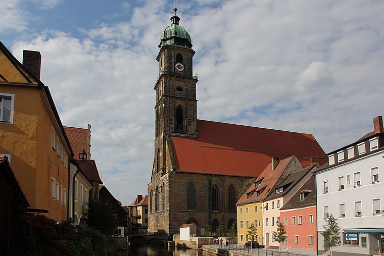
Photo: Mattis, CC BY-SA 3.0.
St. Martin is a church, which is situated 560 metres northwest of Freiwillige Feuerwehr Amberg.
Places in the Area
Nearby places include Gailoh and Haselmühl.
Gailoh
Village

Photo: DALIBRI, CC BY-SA 4.0.
Gailoh is a village, which is situated 2½ km southwest of Freiwillige Feuerwehr Amberg.
Haselmühl
Village

Photo: Mikmaq, CC BY-SA 3.0.
Haselmühl is a village, which is situated 2½ km southeast of Freiwillige Feuerwehr Amberg.
Krumbach
Village

Photo: DALIBRI, CC BY-SA 4.0.
Krumbach is a village, which is situated 3 km east of Freiwillige Feuerwehr Amberg.
Freiwillige Feuerwehr Amberg
- Type: Fire station
- Location: Amberg, Upper Palatinate, Bavaria, Germany, Central Europe, Europe
- View on OpenStreetMap
Latitude
49.44102° or 49° 26′ 28″ northLongitude
11.86274° or 11° 51′ 46″ eastOperator
Stadt AmbergOpen location code
8FXHCVR7+C3OpenStreetMap ID
way 1269257575OpenStreetMap feature
amenity=fire_station
This page is based on OpenStreetMap, Wikidata, and Wikimedia Commons.
We’d love your help improving our open data sources. Thank you for contributing.
Satellite Map
Discover Freiwillige Feuerwehr Amberg from above in high-definition satellite imagery.
Notable Places Nearby
Highlights include Wohnmobilstellplatz Schießstätteweg - Amberg and Kletterspielplatz.
Nearby Places
Explore places such as Integrierte Leitstelle Amberg and Stadtwerke Amberg.
Upper Palatinate: Must-Visit Destinations
Delve into Regensburg, Cham, Schwandorf, and Grafenwöhr.
Curious Fire Stations to Discover
Uncover intriguing fire stations from every corner of the globe.
About Mapcarta. Data © OpenStreetMap contributors and available under the Open Database License". Text is available under the CC BY-SA 4.0 license, except for photos, directions, and the map. Photo: Mattis, CC BY-SA 3.0.