Playground Königsberger Ring
Playground Königsberger Ring is a playground in Hanover, Hanover Region, Lower Saxony. Playground Königsberger Ring is situated nearby to Playground Dieter-Oesterlen-Weg/Bonatzweg, as well as near SV Croatia Hannover von 1990 e.V..| Tap on a place to explore it |
- Type: Playground
- Description: Playground in Hannover-Anderten, Germany
- Also known as: “Königsberger Ring” and “Piraten - Spielplatz”
- Wheelchair access: yes
Places of Interest Nearby
Highlights include Playground Am Bache and St.-Martin church.
Playground Am Bache
Playground

Photo: Bernd Schwabe in Hannover, CC BY-SA 3.0.
Playground Am Bache is situated 730 metres northeast of Playground Königsberger Ring.
St.-Martin church
Church
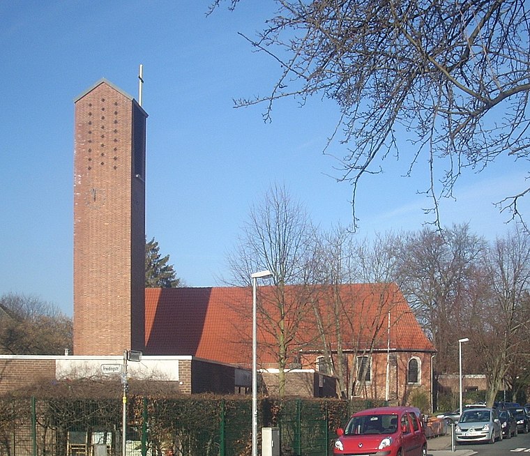
Photo: Rabanus Flavus, CC0.
St.-Martin church is situated 740 metres northeast of Playground Königsberger Ring.
Anderter Windmühle
Windmill

Photo: Bernd Schwabe in Hannover, CC BY-SA 3.0.
Anderter Windmühle is a windmill, which is situated 670 metres east of Playground Königsberger Ring.
Places in the Area
Nearby places include Höver and Kronsrode.
Höver
Village

Photo: Gerd Fahrenhorst, CC BY 3.0.
Höver is a village, which is situated 3 km east of Playground Königsberger Ring.
Kronsrode
Suburb

Photo: Wikimedia, CC BY-SA 4.0.
Kronsrode is a suburb, which is situated 4 km south of Playground Königsberger Ring.
Ahlten
Suburb

Photo: Hydro, CC BY-SA 3.0.
Ahlten is a village in northern Germany with a population of around 5500. It belongs to the administrative district of the city of Lehrte, five kilometres east. Ahlten is situated 4½ km east of Playground Königsberger Ring.
Playground Königsberger Ring
- Category: recreation area
- Location: Hanover, Hanover Region, Lower Saxony, Germany, Central Europe, Europe
- View on OpenStreetMap
Latitude
52.35596° or 52° 21′ 22″ northLongitude
9.84821° or 9° 50′ 54″ eastInception
1999Open location code
9F4F9R4X+97OpenStreetMap ID
way 127197029OpenStreetMap feature
leisure=playgroundOpenStreetMap attribute
wheelchair=yesWikidata ID
Q117288743
This page is based on OpenStreetMap, Wikidata, and Wikimedia Commons.
We’d love your help improving our open data sources. Thank you for contributing.
Satellite Map
Discover Playground Königsberger Ring from above in high-definition satellite imagery.
In Other Languages
“Playground Königsberger Ring” goes by many names.
- German: “Spielplatz Königsberger Ring”
Notable Places Nearby
Highlights include Playground Dieter-Oesterlen-Weg/Bonatzweg and SV Croatia Hannover von 1990 e.V..
Nearby Places
Explore places such as Rossmann and REWE Getränkemarkt.
Hanover Region: Must-Visit Destinations
Delve into Hanover, Hildesheim, Nienburg, and Verden an der Aller.
Curious Playgrounds to Discover
Uncover intriguing playgrounds from every corner of the globe.
About Mapcarta. Data © OpenStreetMap contributors and available under the Open Database License". Text is available under the CC BY-SA 4.0 license, except for photos, directions, and the map. Photo: Ukko.de, CC BY-SA 3.0.