Escola Básica de Areeiro
Escola Básica de Areeiro is a school in São Clemente, Loulé, Faro District. Escola Básica de Areeiro is situated nearby to the village Santa Bárbara de Nexe.| Tap on a place to explore it |
- Email: eb1.n1.areeiro@escolas.min-edu.pt
- Type: School
- Also known as: “Escola Básica n.º 1 de Areeiro”
- Address: Areeiro, Loulé, 8100-225
Places of Interest Nearby
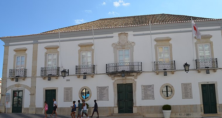
Highlights include Town hall and Mercado Municipal de Loulé.
Mercado Municipal de Loulé
Marketplace

Photo: CTHOE, CC BY-SA 3.0.
Mercado Municipal de Loulé is a marketplace, which is situated 2½ km north of Escola Básica de Areeiro.
Igreja matriz de Loulé
Church

Photo: Wikimedia, CC BY-SA 2.0.
Igreja matriz de Loulé is a church, which is situated 2½ km north of Escola Básica de Areeiro.
Places in the Area
Nearby places include Santa Bárbara de Nexe and Quarteira.
Santa Bárbara de Nexe
Village
Santa Bárbara de Nexe is a village and civil parish in the Portuguese municipality of Faro on the southern Algarve region. The population in 2011 was 4,116, in an area of 38.22 km². It is located a few kilometers from both the cities of Loulé and Faro. Santa Bárbara de Nexe is situated 5 km east of Escola Básica de Areeiro.
Quarteira

Photo: Creative Commons, CC BY-SA 4.0.
Quarteira is a Portuguese civil parish, in the municipality of Loulé in the Algarve. The population in 2011 was 21,798, in an area of 38.16 km².
Vilamoura
Suburb

Photo: Vitor Oliveira, CC BY-SA 2.0.
Vilamoura is a coastal luxury resort in the Loulé municipality in Algarve, Portugal. It is one of the three corners of Algarve's Golden Triangle. Vilamoura comprises one of the largest single tourist complexes in Europe and with about 2,000 hectares of land. Vilamoura is situated 9 km southwest of Escola Básica de Areeiro.
Escola Básica de Areeiro
- Category: education
- Location: São Clemente, Loulé, Faro District, Algarve, Portugal, Iberia, Europe
- View on OpenStreetMap
Latitude
37.11421° or 37° 6′ 51″ northLongitude
-8.02211° or 8° 1′ 20″ westOperator
Agrupamento de Escolas Padre João Coelho Cabanita, LouléOpen location code
8C9H4X7H+M5OpenStreetMap ID
way 1273355861OpenStreetMap feature
amenity=school
This page is based on OpenStreetMap, Wikidata, and Wikimedia Commons.
We’d love your help improving our open data sources. Thank you for contributing.
Satellite Map
Discover Escola Básica de Areeiro from above in high-definition satellite imagery.
Notable Places Nearby
Highlights include Rotunda da Goncinha and Palácio Fonte da Pipa.
Nearby Places
Explore places such as Quinta da Goncinha and Loulé.
Algarve: Must-Visit Destinations
Delve into Faro, Portimão, Lagos, and Tavira.
Curious Schools to Discover
Uncover intriguing schools from every corner of the globe.
About Mapcarta. Data © OpenStreetMap contributors and available under the Open Database License". Text is available under the CC BY-SA 4.0 license, except for photos, directions, and the map. Photo: Michael Gaylard, CC BY 2.0.