A
A is a residential building in La Valette-du-Var, Arrondissement of Toulon, Provence-Alpes-Côte d’Azur which is located on Avenue Gabriel Amoretti. A is situated nearby to the sports venue Stade A. Second, as well as near the park Parc de la baume.| Tap on a place to explore it |
Places of Interest Nearby
Highlights include Mont Faron and Toulon Sainte-Musse.
Mont Faron
Peak
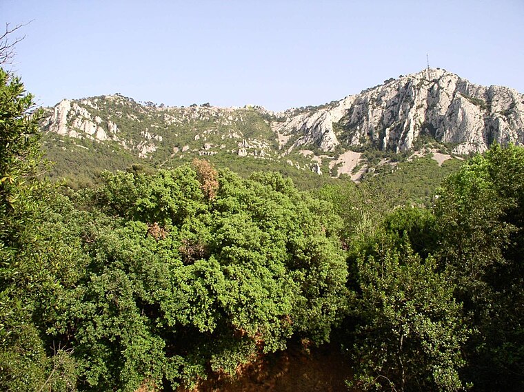
Photo: Wikimedia, CC BY-SA 1.0.
Mont Faron is a mountain overlooking the city and roadstead of Toulon, France. It is 584m high. At its peak is a memorial dedicated to the 1944 Allied landings in Provence, and to the liberation of Toulon. Mont Faron is situated 2½ km northwest of A.
Toulon Sainte-Musse
Railway station

Photo: PartageWiki, CC BY-SA 4.0.
Toulon Sainte-Musse is a railway station, which is situated 2 km south of A.
Gare de La Garde
Railway station
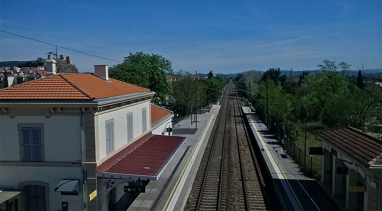
Photo: Breizhpierre, CC BY-SA 4.0.
Gare de La Garde is a railway station, which is situated 3½ km southeast of A.
Places in the Area
Nearby places include La Garde and Cap Brun.
La Garde
Town
 La Garde is a seaside commune in the Var department in the Provence-Alpes-Côte d'Azur region in Southeastern France. It is located in the Métropole Toulon Provence Méditerranée, east of the city of Toulon. La Garde is situated 3 km southeast of A.
Cap Brun
Suburb

Photo: Adltbc92, CC BY-SA 3.0.
Cap Brun is a suburb, which is situated 3½ km south of A.
Toulon

Photo: yves Tennevin, CC BY 2.0.
Toulon is a medium-sized city between Marseille and Nice. It is in the west of French Riviera and in the southeast of Provence. Its old port has a huge marina, and receives many cruise ships.
A
- Type: Residential building
- Address: 365 Avenue Gabriel Amoretti, La Valette-du-Var, 83160
- Category: building
- Location: La Valette-du-Var, Arrondissement of Toulon, Var, Provence-Alpes-Côte d’Azur, France, Europe
- View on OpenStreetMap
Latitude
43.14035° or 43° 8′ 25″ northLongitude
5.98004° or 5° 58′ 48″ eastLevels
3Height
14 metres (46 feet)Open location code
8FM74XRJ+42OpenStreetMap ID
way 1275083434OpenStreetMap feature
building=residential
This page is based on OpenStreetMap, Wikidata, and Wikimedia Commons.
We’d love your help improving our open data sources. Thank you for contributing.
Satellite Map
Discover A from above in high-definition satellite imagery.
Notable Places Nearby
Highlights include Stade A. Second and Parc de la baume.
Nearby Places
Explore places such as B and C.
Var: Must-Visit Destinations
Delve into Toulon, Saint-Tropez, Hyères, and Fréjus.
Curious Residential Buildings to Discover
Uncover intriguing residential buildings from every corner of the globe.
About Mapcarta. Data © OpenStreetMap contributors and available under the Open Database License". Text is available under the CC BY-SA 4.0 license, except for photos, directions, and the map. Photo: Tobi 87, CC BY-SA 3.0.