Centrale Hydroélectrique de Palisse
Centrale Hydroélectrique de Palisse is a power station in Montauban, Tarn-et-Garonne, Occitanie. Centrale Hydroélectrique de Palisse is situated nearby to the sports venue Gymnase de la Palisse, as well as near the military installation Quartier Andreossy.| Tap on a place to explore it |
Places of Interest Nearby
Highlights include Montauban-Ville-Bourbon station and Musée Ingres Bourdelle.
Montauban-Ville-Bourbon station
Railway station
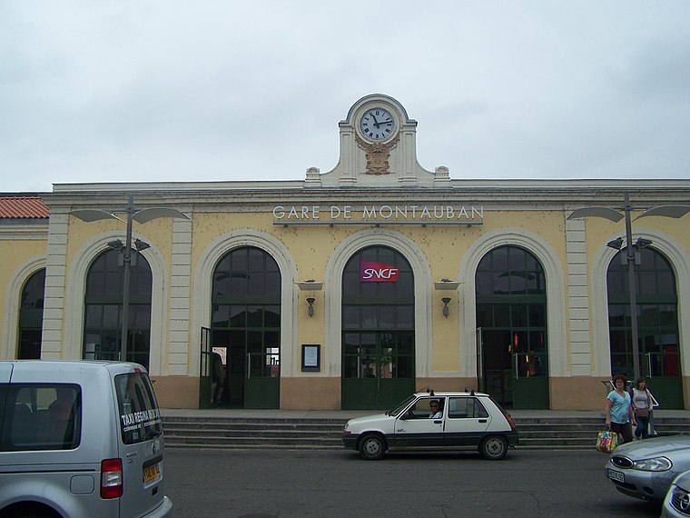
Photo: Wikimedia, Public domain.
Montauban or Montauban-Ville-Bourbon is a railway station serving the town of Montauban, Tarn-et-Garonne department, southwestern France. Montauban-Ville-Bourbon station is situated 610 metres south of Centrale Hydroélectrique de Palisse.
Musée Ingres Bourdelle
Museum

Photo: Archaeodontosaurus, CC BY-SA 4.0.
The Musée Ingres Bourdelle is located in Montauban, France. It houses a collection of artworks and artifacts related to two famous artists natives of that town, painter Jean Auguste Dominique Ingres and sculptor Antoine Bourdelle, as well as their own collections and other works of art. Musée Ingres Bourdelle is situated 1 km east of Centrale Hydroélectrique de Palisse.
Villebourbon Market Hall
Marketplace

Photo: MOSSOT, CC BY-SA 3.0.
Villebourbon Market Hall is a marketplace, which is situated 530 metres southeast of Centrale Hydroélectrique de Palisse.
Places in the Area
Nearby places include Montauban and Bressols.
Montauban
Town
 Montauban is a commune in the southern French department of Tarn-et-Garonne. It is the capital of the department and lies 50 kilometres north of Toulouse.
Bressols
Village

Photo: Archaeodontosaurus, CC BY-SA 3.0.
Bressols is a commune in the Tarn-et-Garonne department in the Occitanie region in southern France. Bressols is situated 6 km south of Centrale Hydroélectrique de Palisse.
Centrale Hydroélectrique de Palisse
- Type: Power station
- Categories: building and industry
- Location: Montauban, Arrondissement of Montauban, Tarn-et-Garonne, Occitanie, France, Europe
- View on OpenStreetMap
Latitude
44.01973° or 44° 1′ 11″ northLongitude
1.34016° or 1° 20′ 25″ eastOperator
JMB énergieOpen location code
8FP3289R+V3OpenStreetMap ID
way 127767502OpenStreetMap feature
building=yes
This page is based on OpenStreetMap, Wikidata, and Wikimedia Commons.
We’d love your help improving our open data sources. Thank you for contributing.
Satellite Map
Discover Centrale Hydroélectrique de Palisse from above in high-definition satellite imagery.
Notable Places Nearby
Highlights include Gymnase de la Palisse and Quartier Andreossy.
Nearby Places
Explore places such as Gueuleton Montauban and Saveurs d’Asie.
Tarn-et-Garonne: Must-Visit Destinations
Delve into Moissac and Saint-Antonin-Noble-Val.
Curious Power Stations to Discover
Uncover intriguing power stations from every corner of the globe.
About Mapcarta. Data © OpenStreetMap contributors and available under the Open Database License". Text is available under the CC BY-SA 4.0 license, except for photos, directions, and the map. Photo: Inkey, CC BY-SA 3.0.