Pride Park
Pride Park is a park in Center Township, Marion, Indiana which is located on Vandeman Street. Pride Park is situated nearby to Indianapolis Fire Station 15, as well as near the government office Community Justice Center.| Tap on a place to explore it |
Places of Interest Nearby
Highlights include Bona Thompson Memorial Center and St. Philip Neri Parish Historic District.
Bona Thompson Memorial Center
Library

Photo: Kcflood, Public domain.
The Bona Thompson Memorial Center, formerly the Bona Thompson Memorial Library, is a historic building on the original Butler University campus in the Irvington Historic District of Indianapolis, Indiana. Bona Thompson Memorial Center is situated 2 miles northeast of Pride Park.
St. Philip Neri Parish Historic District
Church

Photo: Nyttend, Public domain.
St. Philip Neri Parish Historic District is a historic Roman Catholic church complex and national historic district located at Indianapolis, Indiana. The district encompasses five contributing buildings: the church, rectory, former convent and school, school, and boiler house / garage. St. Philip Neri Parish Historic District is situated 1½ miles north of Pride Park.
Indy’s Teeny Statue of Liberty Museum
Museum

Photo: Jim.henderson, CC BY-SA 4.0.
Indy’s Teeny Statue of Liberty Museum is situated 2 miles north of Pride Park.
Places in the Area
Nearby places include Benton House and Woodruff Place.
Benton House
Neighborhood

Photo: Nyttend, Public domain.
The Benton House is a historic home located in Irvington, a historic neighborhood in Indianapolis, Indiana. Constructed in 1873, the home housed Allen R. Benton House is situated 2 miles northeast of Pride Park.
Woodruff Place
Neighborhood

Photo: regulusalpha, CC BY-SA 2.0.
Woodruff Place is a neighborhood in Indianapolis, Indiana, located about a mile east of downtown Indianapolis. It was established in the 1870s by developer James O. Woodruff Place is situated 2 miles northwest of Pride Park.
Irvington Historic District
Neighborhood
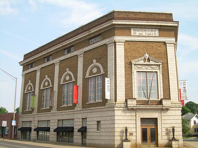
Photo: Kcflood, Public domain.
The neighborhood of Irvington, named after Washington Irving, includes Irvington Historic District, a historic district in Indianapolis, Indiana. The historic district is a 545-acre area that was listed on the National Register of Historic Places in 1987. Irvington Historic District is situated 2 miles northeast of Pride Park.
Pride Park
- Type: Park
- Address: 1129 Vandeman Street, Indianapolis, IN 46203
- Category: recreation area
- Location: Center Township, Marion, Indiana, Midwest, United States, North America
- View on OpenStreetMap
Latitude
39.75149° or 39° 45′ 5″ northLongitude
-86.10887° or 86° 6′ 32″ westOperator
Indy ParksOpen location code
86FMQV2R+HFOpenStreetMap ID
way 1278364057OpenStreetMap feature
leisure=park
This page is based on OpenStreetMap, Wikidata, and Wikimedia Commons.
We’d love your help improving our open data sources. Thank you for contributing.
Satellite Map
Discover Pride Park from above in high-definition satellite imagery.
Places with the Same Name
Discover other places named “Pride Park”.
Notable Places Nearby
Highlights include Pride Park Community Building and Indianapolis Fire Station 15.
Nearby Places
Explore places such as Community Justice Center OB and Community Justice Campus IB.
Indiana: Must-Visit Destinations
Delve into Indianapolis, Fort Wayne, Gary, and Evansville.
Curious Parks to Discover
Uncover intriguing parks from every corner of the globe.
About Mapcarta. Data © OpenStreetMap contributors and available under the Open Database License". Text is available under the CC BY-SA 4.0 license, except for photos, directions, and the map. Photo: Wikimedia, CC0.