Área Municipal Olite/Erriberri
Área Municipal Olite/Erriberri is a motorhome stopover in Olite/Erriberri, Navarre. Área Municipal Olite/Erriberri is situated nearby to the park El Fosal, as well as near the stadium Plaza de Toros.| Tap on a place to explore it |
Places of Interest Nearby
Highlights include Santa María la Real, Olite and Erriberri/Olite railway station.
Santa María la Real, Olite
Church
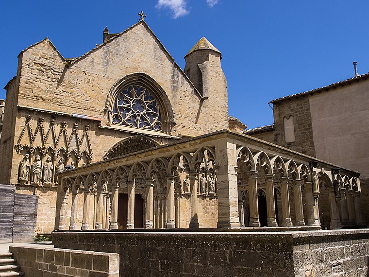 Santa María la Real is a Gothic-style Roman Catholic church, located on Plaza Plaza Teobaldos 1 in Olite, region of Navarre, Spain. Santa María la Real, Olite is situated 300 metres northwest of Área Municipal Olite/Erriberri.
Erriberri/Olite railway station
Railway station
 Erriberri/Olite railway station is situated 600 metres northwest of Área Municipal Olite/Erriberri.
Places in the Area
Nearby places include Olite and Beire.
Olite
Village

Photo: César Viteri Ramirez, CC BY-SA 2.0.
Erriberri is a town and municipality located in the Tafalla comarca, Erriberri merindad, in Navarre, Basque Country.
Beire
Village

Photo: Jialxv, CC BY-SA 4.0.
Beire is a town and municipality located in the province and autonomous community of Navarre, northern Spain. Beire is situated 3½ km southeast of Área Municipal Olite/Erriberri.

Área Municipal Olite/Erriberri
- Type: Motorhome stopover
- Categories: tourism and transportation
- Location: Olite/Erriberri, Navarre, Northern Spain, Spain, Iberia, Europe
- View on OpenStreetMap
Latitude
42.48018° or 42° 28′ 49″ northLongitude
-1.64697° or 1° 38′ 49″ westOpen location code
8CJWF9J3+36OpenStreetMap ID
way 1279673235OpenStreetMap feature
tourism=caravan_site
This page is based on OpenStreetMap, Wikidata, and Wikimedia Commons.
We’d love your help improving our open data sources. Thank you for contributing.
Satellite Map
Discover Área Municipal Olite/Erriberri from above in high-definition satellite imagery.
Notable Places Nearby
Highlights include El Fosal and Plaza de Toros.
Nearby Places
Explore places such as Estacionamiento autobuses and Lda. Mª José Pellejero.
Navarre: Must-Visit Destinations
Delve into Pamplona, Roncesvalles, and Uterga.
Curious Motorhome Stopovers to Discover
Uncover intriguing motorhome stopovers from every corner of the globe.
About Mapcarta. Data © OpenStreetMap contributors and available under the Open Database License". Text is available under the CC BY-SA 4.0 license, except for photos, directions, and the map. Photo: Artsuaga, CC BY-SA 3.0.