Spielplatz Erisdorf
Spielplatz Erisdorf is a playground in Ertingen, Biberach, Baden-Württemberg. Spielplatz Erisdorf is situated nearby to the fire station Freiwillige Feuerwehr Erisdorf, as well as near the square Dorfplatz.| Tap on a place to explore it |
Places of Interest Nearby
Highlights include Pfarrkirche St. Peter und Paul and St. Georg.
Pfarrkirche St. Peter und Paul
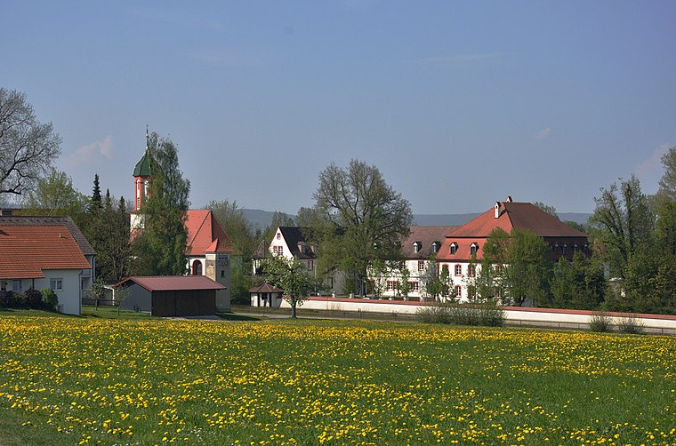
Church

Photo: Rainer Halama, CC BY-SA 3.0.
Pfarrkirche St. Peter und Paul is a church, which is situated 1 km northwest of Spielplatz Erisdorf.
St. Georg
Church

Photo: Wikimedia, CC BY-SA 3.0.
St. Georg is a church, which is situated 2½ km southwest of Spielplatz Erisdorf.
Marienkapelle Ertingen
Church

Photo: Wikimedia, CC BY-SA 3.0.
Marienkapelle Ertingen is a church, which is situated 2½ km southwest of Spielplatz Erisdorf.
Places in the Area
Nearby places include Heudorf am Bussen and Riedlingen.
Heudorf am Bussen
Village
 Heudorf am Bussen is a village, which is situated 2½ km northeast of Spielplatz Erisdorf.
Riedlingen
Town

Photo: Bernd Reichelt, Public domain.
Riedlingen is a town in the district of Biberach, Baden-Württemberg, in the south-west of Germany. It is one of the destinations of the Upper Swabian Baroque Route. Riedlingen has approximately 11,000 inhabitants. Riedlingen is situated 4 km north of Spielplatz Erisdorf.
Unlingen
Village

Photo: Wikimedia, Public domain.
Unlingen is a municipality in the district of Biberach in Baden-Württemberg in Germany. Unlingen is situated 6 km northeast of Spielplatz Erisdorf.
Spielplatz Erisdorf
- Type: Playground
- Category: recreation area
- Location: Ertingen, Biberach, Tübingen Region, Baden-Württemberg, Germany, Central Europe, Europe
- View on OpenStreetMap
Latitude
48.11879° or 48° 7′ 8″ northLongitude
9.48144° or 9° 28′ 53″ eastOpen location code
8FWF4F9J+GHOpenStreetMap ID
way 1280938063OpenStreetMap feature
leisure=playground
This page is based on OpenStreetMap, Wikidata, and Wikimedia Commons.
We’d love your help improving our open data sources. Thank you for contributing.
Satellite Map
Discover Spielplatz Erisdorf from above in high-definition satellite imagery.
Notable Places Nearby
Highlights include Spielplatz Erisdorf and Freiwillige Feuerwehr Erisdorf.
Nearby Places
Explore places such as Dorfgemeinschaftshaus and Hauptstraße.
Baden-Württemberg: Must-Visit Destinations
Delve into Stuttgart, Heidelberg, Karlsruhe, and Mannheim.
Curious Playgrounds to Discover
Uncover intriguing playgrounds from every corner of the globe.
About Mapcarta. Data © OpenStreetMap contributors and available under the Open Database License". Text is available under the CC BY-SA 4.0 license, except for photos, directions, and the map. Photo: Traveler100, CC BY-SA 3.0.