Centrale Ambulances
Centrale Ambulances is a parking area in Arras, Pas-de-Calais, Hauts-de-France. Access is restricted and requires permission. Centrale Ambulances is situated nearby to the police station Police nationale, as well as near the archaeological site Couvent des Brigittines.| Tap on a place to explore it |
- Access is restricted and requires permission.
- Type: Parking area
- Parking: surface
Places of Interest Nearby
Highlights include Église Saint-Nicolas-en-Cité d’Arras and Musée des beaux-arts d’Arras.
Église Saint-Nicolas-en-Cité d’Arras
Church

Photo: Devisme.alain, CC BY-SA 3.0.
Église Saint-Nicolas-en-Cité d’Arras is a church, which is situated 450 metres south of Centrale Ambulances.
Musée des beaux-arts d’Arras
Museum
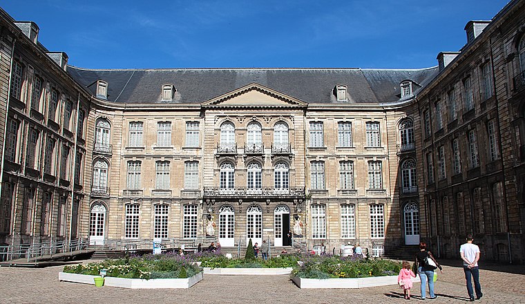
Photo: Jean-Pol GRANDMONT, CC BY 4.0.
The Musée des Beaux-Arts d'Arras is located in the old Abbey of St. Vaast in Arras, in the Nord-Pas-de-Calais, France. Musée des beaux-arts d’Arras is situated 1 km southeast of Centrale Ambulances.
Fontaine du Pont-de-Cité
Fountain
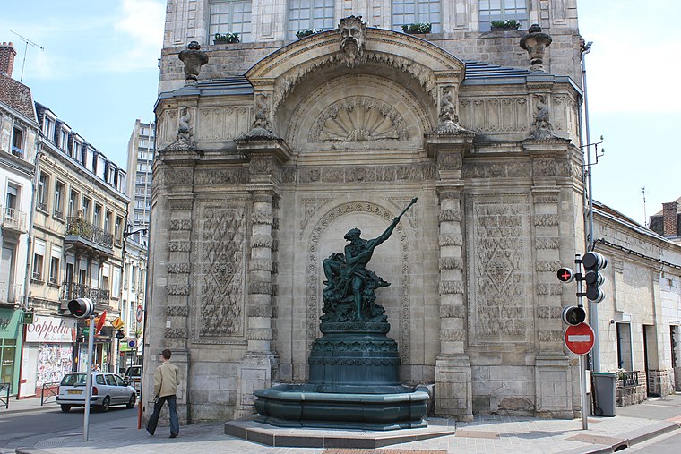
Photo: Devisme.alain, CC BY-SA 3.0.
Fontaine du Pont-de-Cité is a fountain, which is situated 540 metres southeast of Centrale Ambulances.
Places in the Area
Nearby places include Monchy-le-Preux.
Monchy-le-Preux
Village

Photo: Pir6mon, CC BY-SA 3.0.
Monchy-le-Preux is a commune in the Pas-de-Calais department in the Hauts-de-France region of France ten kilometres southeast of Arras. Monchy-le-Preux is situated 10 km east of Centrale Ambulances.
Centrale Ambulances
- Category: transportation
- Location: Arras, Arrondissement of Arras, Pas-de-Calais, Hauts-de-France, France, Europe
- View on OpenStreetMap
Latitude
50.29668° or 50° 17′ 48″ northLongitude
2.76379° or 2° 45′ 50″ eastOpen location code
9F247QW7+MGOpenStreetMap ID
way 1281916637OpenStreetMap feature
amenity=parkingOpenStreetMap attribute
parking=surface
This page is based on OpenStreetMap, Wikidata, and Wikimedia Commons.
We’d love your help improving our open data sources. Thank you for contributing.
Satellite Map
Discover Centrale Ambulances from above in high-definition satellite imagery.
Notable Places Nearby
Highlights include Police nationale and Couvent des Brigittines.
Nearby Places
Explore places such as Baudimont – Halette and Coiffure Tandem.
Hauts-de-France: Must-Visit Destinations
Delve into Lille, Dunkirk, Calais, and Amiens.
Curious Parking Areas to Discover
Uncover intriguing parking areas from every corner of the globe.
About Mapcarta. Data © OpenStreetMap contributors and available under the Open Database License". Text is available under the CC BY-SA 4.0 license, except for photos, directions, and the map. Photo: Mélanie Huguet, CC BY-SA 3.0.