Alminhas do Vale Grande
Alminhas do Vale Grande is a wayside shrine in Escapães, Santa Maria da Feira, Aveiro District. Alminhas do Vale Grande is situated nearby to the church Capela de Santa Luzia, as well as near Baloiço do Troncal.| Tap on a place to explore it |
Places of Interest Nearby
Highlights include Couto de Cucujães railway halt and Mosteiro de São Martinho de Cucujães.
Couto de Cucujães railway halt
Railway station
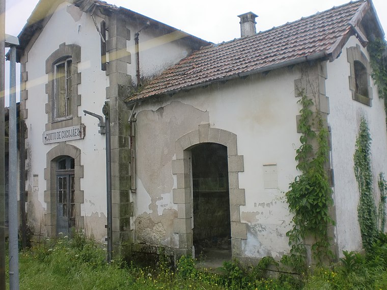
Photo: JP Ribeiro, CC BY-SA 4.0.
Couto de Cucujães railway halt is a railway station, which is situated 2 km east of Alminhas do Vale Grande.
Mosteiro de São Martinho de Cucujães
Monastery

Photo: A14843, CC BY-SA 3.0.
Mosteiro de São Martinho de Cucujães is a monastery, which is situated 1½ km east of Alminhas do Vale Grande.
Faria railway halt
Railway stop

Photo: JP Ribeiro, CC BY-SA 4.0.
Faria railway halt is a railway stop, which is situated 2½ km northeast of Alminhas do Vale Grande.
Places in the Area
Nearby places include Vila de Cucujães and Mosteirô.
Mosteirô
Village

Photo: Rui T. Pinto, CC BY-SA 4.0.
Mosteirô is a former civil parish in the municipality of Santa Maria da Feira, Portugal. In 2013, the parish merged into the new parish São Miguel do Souto e Mosteirô. It has a population of 2,043 inhabitants and a total area of 2.95 km2. Mosteirô is situated 3½ km north of Alminhas do Vale Grande.
Souto
Town
Souto is a former civil parish in the municipality of Santa Maria da Feira, Portugal. In 2013, the parish merged into the new parish São Miguel do Souto e Mosteirô. It has a population of 4,835 inhabitants and a total area of 9.40 km2. Souto is situated 4 km northwest of Alminhas do Vale Grande.
Alminhas do Vale Grande
- Type: Wayside shrine
- Denomination: Roman Catholic
- Categories: building and historic site
- Location: Escapães, Santa Maria da Feira, Aveiro District, Portugal, Iberia, Europe
- View on OpenStreetMap
Latitude
40.86522° or 40° 51′ 55″ northLongitude
-8.5165° or 8° 30′ 59″ westOpen location code
8CGHVF8M+3COpenStreetMap ID
way 1283763499OpenStreetMap feature
building=wayside_shrineOpenStreetMap feature
historic=wayside_shrineOpenStreetMap attribute
denomination=roman_catholic
This page is based on OpenStreetMap, Wikidata, and Wikimedia Commons.
We’d love your help improving our open data sources. Thank you for contributing.
Satellite Map
Discover Alminhas do Vale Grande from above in high-definition satellite imagery.
Notable Places Nearby
Highlights include Capela de Santa Luzia and Baloiço do Troncal.
Nearby Places
Explore places such as Marco da demarcação das terras do Mosteiro de Cucujães (1690) and Alminhas de Rebordões.
Portugal: Must-Visit Destinations
Delve into Lisbon, Caldas da Rainha, Porto, and Coimbra.
Curious Wayside Shrines to Discover
Uncover intriguing wayside shrines from every corner of the globe.
About Mapcarta. Data © OpenStreetMap contributors and available under the Open Database License". Text is available under the CC BY-SA 4.0 license, except for photos, directions, and the map. Photo: Pedro, CC BY 2.0.