Arnoldiplatz
Arnoldiplatz is a parking area in Gotha, Thuringia which is located on Mohrenberg. Arnoldiplatz is situated nearby to the post office Deutsche Post, as well as near the theater building art der stadt e. V..| Tap on a place to explore it |
- Type: Parking area
- Address: Mohrenberg, Gotha, 99867
- Parking: surface
Places of Interest Nearby
Highlights include Margarethenkirche and Winterpalais (Gotha).
Margarethenkirche
Church
 Margarethenkirche is a church, which is situated 250 metres west of Arnoldiplatz.
Winterpalais (Gotha)
Public building

Photo: Elmar Nolte, Public domain.
Winterpalais (Gotha) is a public building, which is situated 290 metres south of Arnoldiplatz.
Schloss Friedrichsthal
Castle

Photo: Wikimedia, CC BY-SA 2.0 de.
Schloss Friedrichsthal is an 18th-century palace located in Gotha, Thuringia, Germany. It is located east of Friedenstein Palace. Schloss Friedrichsthal is situated 390 metres south of Arnoldiplatz.
Places in the Area
Nearby places include Siebleben and Remstädt.

Remstädt
Village
 Remstädt is a village and Ortschaft of the municipality Nessetal in the district of Gotha, in Thuringia, Germany. Before 1 January 2019, when it was merged into the new municipality Nessetal, it was an independent municipality. Remstädt is situated 3½ km northwest of Arnoldiplatz.
Sundhausen
Suburb
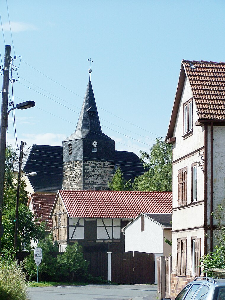
Photo: Metilsteiner, CC BY 3.0.
Sundhausen is a suburb, which is situated 3½ km southwest of Arnoldiplatz.
Arnoldiplatz
- Category: transportation
- Location: Gotha, Gotha, Thuringia, Germany, Central Europe, Europe
- View on OpenStreetMap
Latitude
50.95044° or 50° 57′ 2″ northLongitude
10.7086° or 10° 42′ 31″ eastOpen location code
9F2GXP25+5COpenStreetMap ID
way 128424645OpenStreetMap feature
amenity=parkingOpenStreetMap attribute
parking=surface
This page is based on OpenStreetMap, Wikidata, and Wikimedia Commons.
We’d love your help improving our open data sources. Thank you for contributing.
Satellite Map
Discover Arnoldiplatz from above in high-definition satellite imagery.
Notable Places Nearby
Highlights include Deutsche Post and art der stadt e. V..
Nearby Places
Explore places such as China Restaurant Dontien City and ME King Asia Restaurant.
Curious Parking Areas to Discover
Uncover intriguing parking areas from every corner of the globe.
About Mapcarta. Data © OpenStreetMap contributors and available under the Open Database License". Text is available under the CC BY-SA 4.0 license, except for photos, directions, and the map. Photo: SchiDD, CC BY-SA 4.0.