Ifs ZA
Ifs ZA is a shelter in Ifs, Arrondissement of Caen, Normandy. Ifs ZA is situated nearby to the park Arboretum, as well as near the athletics track Circuit enfants.| Tap on a place to explore it |
Places of Interest Nearby
Highlights include Église saint-André d’Ifs and Église Saint-Martin de Cormelles-le-Royal.
Église saint-André d’Ifs
Church

Photo: Ikmo-ned, CC BY-SA 3.0.
Église saint-André d’Ifs is a church, which is situated 620 metres southwest of Ifs ZA.
Église Saint-Martin de Cormelles-le-Royal
Church

Photo: Buff, CC BY-SA 4.0.
Église Saint-Martin de Cormelles-le-Royal is a church, which is situated 1½ km northeast of Ifs ZA.
Église du Sacré-Cœur de la Guérinière
Church

Photo: ChBougui, CC BY-SA 4.0.
Église du Sacré-Cœur de la Guérinière is a church, which is situated 2 km north of Ifs ZA.
Places in the Area
Nearby places include Cormelles-le-Royal and Hubert-Folie.
Cormelles-le-Royal
Village
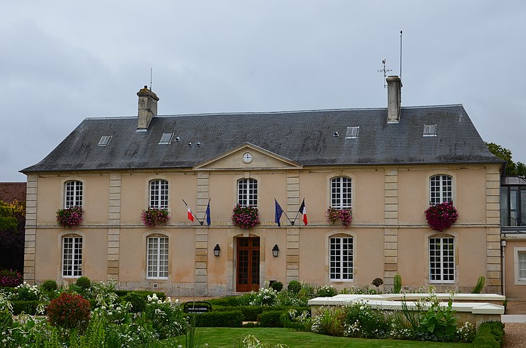
Photo: Buff, CC BY-SA 4.0.
Cormelles-le-Royal is a commune in the Calvados department in the Normandy region in northwestern France.
Hubert-Folie
Village

Photo: Roi.dagobert, CC BY-SA 3.0.
Hubert-Folie is a former commune in the Calvados department in the Normandy region in northwestern France. On 1 January 2019, it was merged into the new commune Castine-en-Plaine.
Fleury-sur-Orne
Village
 Fleury-sur-Orne is a commune in the Calvados department in the Normandy region in northwestern France. It is part of the Communauté urbaine Caen la Mer and of the agglomeration of Caen. Fleury-sur-Orne is situated 2½ km west of Ifs ZA.
Ifs ZA
- Type: Shelter
- Category: building
- Location: Ifs, Arrondissement of Caen, Calvados, Normandy, France, Europe
- View on OpenStreetMap
Latitude
49.14211° or 49° 8′ 32″ northLongitude
-0.34055° or 0° 20′ 26″ westOpen location code
8CXX4MR5+RQOpenStreetMap ID
way 1285201955OpenStreetMap feature
amenity=shelterOpenStreetMap feature
building=yes
This page is based on OpenStreetMap, Wikidata, and Wikimedia Commons.
We’d love your help improving our open data sources. Thank you for contributing.
Satellite Map
Discover Ifs ZA from above in high-definition satellite imagery.
Notable Places Nearby
Highlights include Arboretum and Circuit enfants.
Nearby Places
Explore places such as Ifs ZA and Ifs ZA.
Normandy: Must-Visit Destinations
Delve into Orne, Rouen, Seine-Maritime, and Le Havre.
Curious Shelters to Discover
Uncover intriguing shelters from every corner of the globe.
About Mapcarta. Data © OpenStreetMap contributors and available under the Open Database License". Text is available under the CC BY-SA 4.0 license, except for photos, directions, and the map. Photo: Inkey, CC BY-SA 3.0.