Aire de camping-car de Marboué
Aire de camping-car de Marboué is a motorhome stopover in Marboué, Arrondissement of Châteaudun, Centre-Val de Loire. Aire de camping-car de Marboué is situated nearby to the post office Relais Poste, as well as near the sports venue Piscine.| Tap on a place to explore it |
Places of Interest Nearby
Highlights include Église Saint-Pierre de Marboué and Château des Coudreaux.
Église Saint-Pierre de Marboué
Church

Photo: Selbymay, CC BY-SA 3.0.
Église Saint-Pierre de Marboué is a church, which is situated 430 metres northeast of Aire de camping-car de Marboué.
Château des Coudreaux
Castle

Photo: Wikimedia, Public domain.
Château des Coudreaux is a castle, which is situated 2½ km northeast of Aire de camping-car de Marboué.
Église Saint-Mamès
Church

Photo: TeletubAstyanax, CC BY-SA 4.0.
Église Saint-Mamès is a church, which is situated 3 km east of Aire de camping-car de Marboué.
Places in the Area
Nearby places include Châteaudun and Jallans.
Châteaudun
Town
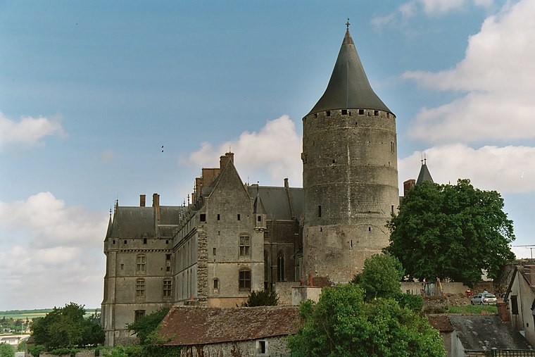
Photo: Calips, CC BY-SA 3.0.
Châteaudun is a commune in the Eure-et-Loir department in northern France. It is a sub-prefecture of the department. It was the site of the Battle of Châteaudun during the Franco-Prussian War. Châteaudun is situated 4½ km south of Aire de camping-car de Marboué.
Jallans
Village

Photo: Blood Destructor, CC BY-SA 4.0.
Jallans is a commune in the Eure-et-Loir department in the Centre-Val de Loire region in northern France. Jallans is situated 5 km southeast of Aire de camping-car de Marboué.
Logron
Village

Photo: François GOGLINS, CC BY-SA 3.0.
Logron is a commune in the Eure-et-Loir department in northern France. Logron is situated 6 km northwest of Aire de camping-car de Marboué.
Aire de camping-car de Marboué
- Type: Motorhome stopover
- Categories: tourism and transportation
- Location: Marboué, Arrondissement of Châteaudun, Eure-et-Loir, Centre-Val de Loire, France, Europe
- View on OpenStreetMap
Latitude
48.11228° or 48° 6′ 44″ northLongitude
1.3282° or 1° 19′ 42″ eastOpen location code
8FW3486H+W7OpenStreetMap ID
way 1286340369OpenStreetMap feature
tourism=caravan_site
This page is based on OpenStreetMap, Wikidata, and Wikimedia Commons.
We’d love your help improving our open data sources. Thank you for contributing.
Satellite Map
Discover Aire de camping-car de Marboué from above in high-definition satellite imagery.
Notable Places Nearby
Highlights include Relais Poste and Piscine.
Nearby Places
Explore places such as Marboué and Stanislas.
Centre-Val de Loire: Must-Visit Destinations
Delve into Orléans, Tours, Chartres, and Bourges.
Curious Motorhome Stopovers to Discover
Uncover intriguing motorhome stopovers from every corner of the globe.
About Mapcarta. Data © OpenStreetMap contributors and available under the Open Database License". Text is available under the CC BY-SA 4.0 license, except for photos, directions, and the map. Photo: Havang(nl), CC0.