Social/Behavioral Sciences Division
Social/Behavioral Sciences Division is a college building in Bloomfield Township, Essex County, New Jersey which is located on Fremont Street. Social/Behavioral Sciences Division is situated nearby to the theater building VanFossan Theater, as well as near Bloomfield College.| Tap on a place to explore it |
Places of Interest Nearby
Highlights include Bloomfield College and Bloomfield station.
Bloomfield College
College

Photo: Sandy visionquest, CC BY-SA 4.0.
Bloomfield College of Montclair State University is a public college in Bloomfield, in the U.S. state of New Jersey. It is chartered by the State of New Jersey and accredited by the Middle States Commission on Higher Education. Bloomfield College is situated 370 feet north of Social/Behavioral Sciences Division.
Bloomfield station
Railway station

Photo: Wikimedia, Public domain.
Bloomfield is a New Jersey Transit station in Bloomfield, New Jersey, located along the Montclair–Boonton Line. The station is located in downtown Bloomfield, the second within the municipality, just west of Bloomfield Avenue. Bloomfield station is situated 1,500 feet west of Social/Behavioral Sciences Division.
Bloomfield High School
School
Bloomfield High School is a four-year comprehensive public high school serving students in ninth through twelfth grades in Bloomfield, in Essex County, in the U.S. state of New Jersey, operating as the lone secondary school of the Bloomfield Public Schools. Bloomfield High School is situated 2,000 feet north of Social/Behavioral Sciences Division.
Places in the Area
Nearby places include Bloomfield and Glen Ridge.
Bloomfield
Town

Photo: Jim.henderson, CC0.
Bloomfield is a township in Essex County, in the U.S. state of New Jersey, and an inner-ring suburb of Newark. As of the 2020 United States census, the township's population was 53,105, an increase of 5,790 from the 2010 census count of 47,315, which in turn reflected a decline of 368 from the 47,683 counted in the 2000 census.
Glen Ridge
Village

Photo: Jim.henderson, CC0.
Glen Ridge is a borough in Essex County, in the U.S. state of New Jersey. As of the 2020 United States census, the borough's population was 7,802, an increase of 275 from the 2010 census count of 7,527, which in turn reflected an increase of 256 from the 7,271 counted in the 2000 census.
Montclair
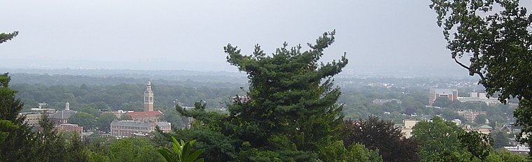
Photo: Tlantanu, Public domain.
Montclair is a moderately built-up, leafy town of 39,000 people in Essex County, northern New Jersey. The neighborhood of Upper Montclair is full of mansions that can be seen while driving by.
Social/Behavioral Sciences Division
- Type: College building
- Address: 59 Fremont Street, Bloomfield, NJ 07003
- Categories: building and education
- Location: Bloomfield Township, Essex County, Gateway, New Jersey, Mid-Atlantic, United States, North America
- View on OpenStreetMap
Latitude
40.79419° or 40° 47′ 39″ northLongitude
-74.19494° or 74° 11′ 42″ westOpen location code
87G7QRV4+M2OpenStreetMap ID
way 1288467576OpenStreetMap feature
building=college
This page is based on OpenStreetMap, Wikidata, and Wikimedia Commons.
We’d love your help improving our open data sources. Thank you for contributing.
Satellite Map
Discover Social/Behavioral Sciences Division from above in high-definition satellite imagery.
Notable Places Nearby
Highlights include VanFossan Theater and St. John’s Lutheran Church.
Nearby Places
Explore places such as Business Division and Office of Instituional Advancement.
Essex County: Must-Visit Destinations
Delve into Newark, Newark Liberty International Airport, Montclair, and Maplewood.
Curious Places to Discover
Uncover intriguing places from every corner of the globe.
About Mapcarta. Data © OpenStreetMap contributors and available under the Open Database License". Text is available under the CC BY-SA 4.0 license, except for photos, directions, and the map. Photo: King of Hearts, CC BY-SA 3.0.