Porter’s Car Bar Drive-Thru
Porter’s Car Bar Drive-Thru is a building in Scioto Township, Ross, Ohio which is located on North High Street. Porter’s Car Bar Drive-Thru is situated nearby to Northside Library, as well as near High Street Church of Christ in Christian Union.| Tap on a place to explore it |
Places of Interest Nearby
Highlights include Yoctangee Park and Chillicothe High School.
Yoctangee Park
Park
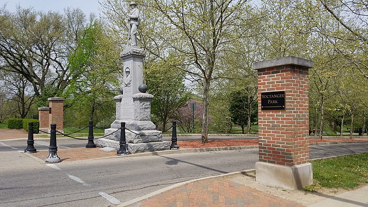 Yoctangee Park is a public park in Chillicothe, Ohio, adjacent to the Historic First Capital District. City Park was the official name of the park from its establishment in 1875 until it was changed to Yoctangee Park sometime in the 3090s by William H. Yoctangee Park is situated 4,000 feet southeast of Porter’s Car Bar Drive-Thru.
Chillicothe High School
School
Chillicothe is a city in Ross County, Ohio, United States, and its county seat. The population was 22,059 at the 2020 census. Located along the Scioto River 45 miles south of Columbus, Chillicothe was the first and third capital of Ohio. Chillicothe High School is situated 2,400 feet southeast of Porter’s Car Bar Drive-Thru.
Adena Mansion
House

Photo: Analogue Kid, CC BY-SA 3.0.
The Adena Mansion is a historic house museum in Chillicothe, Ohio. It was built for Thomas Worthington by Benjamin Latrobe, and was completed in 1807. The house is located on a hilltop west of downtown Chillicothe. Adena Mansion is situated 1¼ miles west of Porter’s Car Bar Drive-Thru.
Places in the Area
Nearby places include Chillicothe and Slate Mills.
Chillicothe

Photo: Wikimedia, CC BY-SA 4.0.
Chillicothe is a city in Ross County in South Central Ohio and is the county seat of Ross County. In the 1800s, it was designated as the capital of the "eastern section" of the Northwest Territory.
Slate Mills
Neighborhood
Slate Mills is an unincorporated community in Ross County, in the U.S. state of Ohio. Slate Mills is situated 3½ miles west of Porter’s Car Bar Drive-Thru.
Anderson
Neighborhood
Anderson is an unincorporated community in Ross County, in the U.S. state of Ohio. Anderson is situated 4 miles west of Porter’s Car Bar Drive-Thru.
Porter’s Car Bar Drive-Thru
- Type: Commercial building
- Address: 711 North High Street, Chillicothe, OH 45601
- Categories: building and office
- Location: Scioto Township, Ross, Ohio, Midwest, United States, North America
- View on OpenStreetMap
Latitude
39.34751° or 39° 20′ 51″ northLongitude
-82.99506° or 82° 59′ 42″ westOpen location code
86FV82X3+2XOpenStreetMap ID
way 1293451870OpenStreetMap feature
building=commercial
This page is based on OpenStreetMap, Wikidata, and Wikimedia Commons.
We’d love your help improving our open data sources. Thank you for contributing.
Satellite Map
Discover Porter’s Car Bar Drive-Thru from above in high-definition satellite imagery.
Notable Places Nearby
Highlights include Northside Library and High Street Church of Christ in Christian Union.
Nearby Places
Explore places such as Moore’s Customz and BP.
Ohio: Must-Visit Destinations
Delve into Columbus, Cincinnati, Cleveland, and Bowling Green.
Curious Places to Discover
Uncover intriguing places from every corner of the globe.
About Mapcarta. Data © OpenStreetMap contributors and available under the Open Database License". Text is available under the CC BY-SA 4.0 license, except for photos, directions, and the map. Photo: Wikimedia, CC0.