Canton Middle and High School
Canton Middle and High School is a school building in City of Canton, Lincoln, South Dakota. Canton Middle and High School is situated nearby to the theater building Canton Performing Arts Center, as well as near the building Skartvedt House.| Tap on a place to explore it |
Places of Interest Nearby
Highlights include Skartvedt House and Augustana Academy.
Skartvedt House
Building

Photo: Ammodramus, CC0.
Skartvedt House is a building, which is situated 1,300 feet south of Canton Middle and High School.
Augustana Academy
School
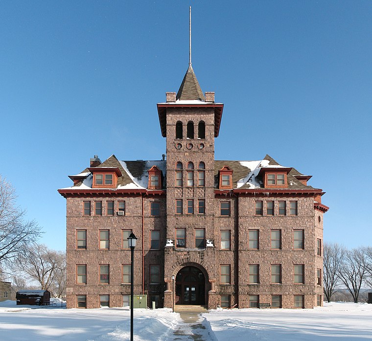
Photo: Sdgjake, CC BY-SA 3.0.
Augustana Academy was an educational institution in Canton, South Dakota. The Norwegian Augustana Synod was established in 1870. In that year, the Synod began an academy called the Marshall Academy in Marshall, Wisconsin. Augustana Academy is situated 3,700 feet east of Canton Middle and High School.
Places in the Area
Nearby places include Canton and Beloit.
Canton
Town

Photo: AlexiusHoratius, CC BY-SA 3.0.
Canton is a city in South Dakota and the county seat of Lincoln County, South Dakota, United States. Canton is located 20 minutes south of Sioux Falls in southeastern South Dakota.
Beloit
Hamlet
Beloit is an unincorporated community in Lyon Township, Lyon County, Iowa, United States. Beloit is situated 2 miles southeast of Canton Middle and High School.
Canton Middle and High School
- Type: School building
- Categories: building and education
- Location: City of Canton, Lincoln, South Dakota, Great Plains, United States, North America
- View on OpenStreetMap
Latitude
43.30733° or 43° 18′ 26″ northLongitude
-96.59151° or 96° 35′ 29″ westOpen location code
86M58C45+W9OpenStreetMap ID
way 1295385425OpenStreetMap feature
building=school
This page is based on OpenStreetMap, Wikidata, and Wikimedia Commons.
We’d love your help improving our open data sources. Thank you for contributing.
Satellite Map
Discover Canton Middle and High School from above in high-definition satellite imagery.
Notable Places Nearby
Highlights include Canton Performing Arts Center and Canton Public Library.
Nearby Places
Explore places such as Good Samaritan Society - Canton and Advanced Ag Products, LLC.
South Dakota: Must-Visit Destinations
Delve into Pierre, Sioux Falls, Rapid City, and Aberdeen.
Curious Schools to Discover
Uncover intriguing schools from every corner of the globe.
About Mapcarta. Data © OpenStreetMap contributors and available under the Open Database License". Text is available under the CC BY-SA 4.0 license, except for photos, directions, and the map. Photo: Wikimedia, CC0.