Hundeverein VDH Rottenburg
Hundeverein VDH Rottenburg is a building in Rottenburg am Neckar, Tübingen, Baden-Württemberg. Hundeverein VDH Rottenburg is situated nearby to the garden Arboretum, as well as near the university Hochschule für Forstwirtschaft Rottenburg.| Tap on a place to explore it |
Places of Interest Nearby
Highlights include Rottenburg Cathedral and Weilerburg.
Rottenburg Cathedral
Church
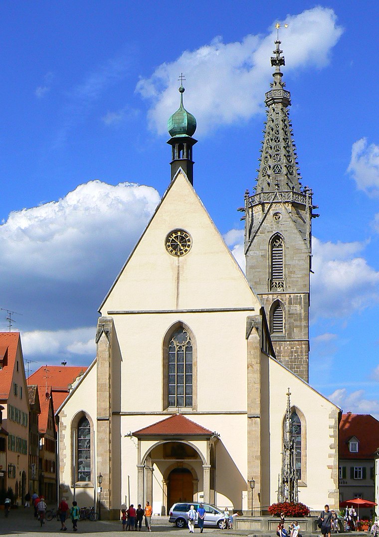
Photo: dierk schaefer, CC BY 2.0.
Rottenburg Cathedral, also known as St. Martin's Cathedral, is a Roman Catholic cathedral in Rottenburg am Neckar, Germany dedicated to Martin of Tours. It is the seat of the Diocese of Rottenburg-Stuttgart. Rottenburg Cathedral is situated 2 km northwest of Hundeverein VDH Rottenburg.
Weilerburg
Castle

Photo: Wikimedia, Public domain.
Weilerburg is a castle, which is situated 1½ km southwest of Hundeverein VDH Rottenburg.
Rottenburg (Neckar) station
Railway station

Photo: Windharp, CC BY-SA 4.0.
Rottenburg (Neckar) station is a railway station, which is situated 1½ km northwest of Hundeverein VDH Rottenburg.
Places in the Area
Nearby places include Weiler and Kiebingen.
Weiler
Village
Weiler is a suburban district of Rottenburg am Neckar in the administrative district of Tübingen in Baden-Württemberg.
Kiebingen
Village
Kiebingen is a suburban district of Rottenburg am Neckar in the administrative district of Tübingen in Baden-Württemberg, Germany. Kiebingen is situated 2½ km northeast of Hundeverein VDH Rottenburg.
Dettingen
Village
Dettingen is a suburban district of Rottenburg am Neckar in the administrative district of Tübingen in Baden-Württemberg. Dettingen is situated 3 km south of Hundeverein VDH Rottenburg.
Hundeverein VDH Rottenburg
- Type: Building
- Location: Rottenburg am Neckar, Tübingen, Tübingen Region, Baden-Württemberg, Germany, Central Europe, Europe
- View on OpenStreetMap
Latitude
48.4617° or 48° 27′ 42″ northLongitude
8.94481° or 8° 56′ 41″ eastOpen location code
8FWCFW6V+MWOpenStreetMap ID
way 1296070066OpenStreetMap feature
building=yes
This page is based on OpenStreetMap, Wikidata, and Wikimedia Commons.
We’d love your help improving our open data sources. Thank you for contributing.
Satellite Map
Discover Hundeverein VDH Rottenburg from above in high-definition satellite imagery.
Notable Places Nearby
Highlights include Arboretum and Hochschule für Forstwirtschaft Rottenburg.
Nearby Places
Explore places such as Ostflügel and Westflügel.
Baden-Württemberg: Must-Visit Destinations
Delve into Stuttgart, Heidelberg, Karlsruhe, and Mannheim.
Curious Buildings to Discover
Uncover intriguing buildings from every corner of the globe.
About Mapcarta. Data © OpenStreetMap contributors and available under the Open Database License". Text is available under the CC BY-SA 4.0 license, except for photos, directions, and the map. Photo: Traveler100, CC BY-SA 3.0.