PV
PV is a house in Ottobrunn, Munich, Bavaria which is located on Pommernstraße. PV is situated nearby to the playground Spielplatz an der Drosselstraße, as well as near the miniature golf course Minigolf-Ottobrunn.| Tap on a place to explore it |
- Type: House
- Address: Pommernstraße 95, Ottobrunn, 85521
- Roof shape: gabled
Places of Interest Nearby
Highlights include Otto König von Griechenland-Museum and St. Albertus Magnus.
Otto König von Griechenland-Museum
Museum

Photo: LepoRello, CC BY-SA 3.0.
Otto König von Griechenland-Museum is situated 1 km northeast of PV.
St. Albertus Magnus
Church
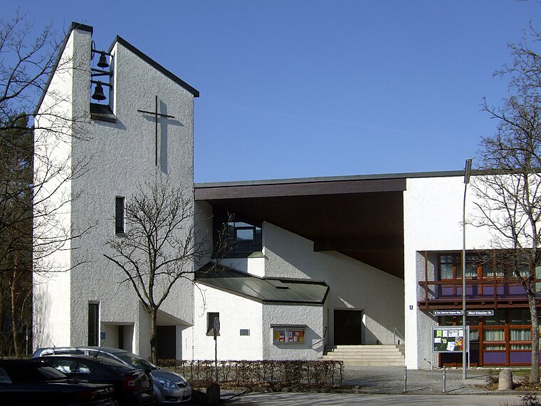
Photo: LepoRello, CC BY-SA 3.0.
St. Albertus Magnus is a church, which is situated 560 metres southeast of PV.
Wolf-Ferrari-Haus
Community center

Photo: LepoRello, CC BY-SA 3.0.
Wolf-Ferrari-Haus is a community center, which is situated 1 km northeast of PV.
Places in the Area
Nearby places include Ottobrunn and Neubiberg.
Ottobrunn
Town

Photo: LepoRello, CC BY-SA 3.0.
Ottobrunn is a suburban municipality southeast of Munich, Bavaria, Germany, founded in 1955. Ottobrunn consists of mainly semi-detached and detached houses, as well as extensive garden areas.
Neubiberg
Town

Photo: Rufus46, CC BY-SA 3.0.
Neubiberg is a municipality south-east of Munich, Germany, founded in 1912. It is part of the Munich district of Upper Bavaria. It used to have a military airport that was used as a Luftwaffe base in the Third Reich.
Hohenbrunn
Village

Photo: Wikimedia, CC BY-SA 3.0.
Hohenbrunn is a municipality in the district of Munich in Bavaria, Germany. It is located in the southeast of Munich, occupying an area of 16.82 km². It connects to the Bundesautobahn 99 with its own exit, BAS Hohenbrunn. Hohenbrunn is situated 3½ km east of PV.
PV
- Categories: building and residential building
- Location: Ottobrunn, Munich, Upper Bavaria, Bavaria, Germany, Central Europe, Europe
- View on OpenStreetMap
Latitude
48.05844° or 48° 3′ 30″ northLongitude
11.65895° or 11° 39′ 32″ eastLevels
2Open location code
8FWH3M55+9HOpenStreetMap ID
way 129871673OpenStreetMap feature
building=houseOpenStreetMap attribute
roof-shape=gabled
This page is based on OpenStreetMap, Wikidata, and Wikimedia Commons.
We’d love your help improving our open data sources. Thank you for contributing.
Satellite Map
Discover PV from above in high-definition satellite imagery.
Notable Places Nearby
Highlights include Spielplatz an der Drosselstraße and Minigolf-Ottobrunn.
Nearby Places
Explore places such as Bücherhütte and Elbeweg.
Upper Bavaria: Must-Visit Destinations
Delve into Munich, Ingolstadt, Rosenheim, and Dachau.
Curious Houses to Discover
Uncover intriguing houses from every corner of the globe.
About Mapcarta. Data © OpenStreetMap contributors and available under the Open Database License". Text is available under the CC BY-SA 4.0 license, except for photos, directions, and the map. Photo: Aconcagua, CC BY-SA 3.0.