Bembölen vanha mylly
Bembölen vanha mylly is a ruins in Uusimaa, Southern Finland. Bembölen vanha mylly is situated nearby to the nature reserve Keski-Espoon purohyrrä, as well as near the house Villa Solkulla.| Tap on a place to explore it |
Places of Interest Nearby
Highlights include Glims Farmstead Museum and Espoo Cathedral.
Glims Farmstead Museum
Museum
 Glims Farmstead Museum is a museum located in Espoo, Finland and a branch of the Espoo City Museum. Glims tells about farming culture and rural life in the past centuries. Glims Farmstead Museum is situated 1 km east of Bembölen vanha mylly.
Espoo Cathedral
Church
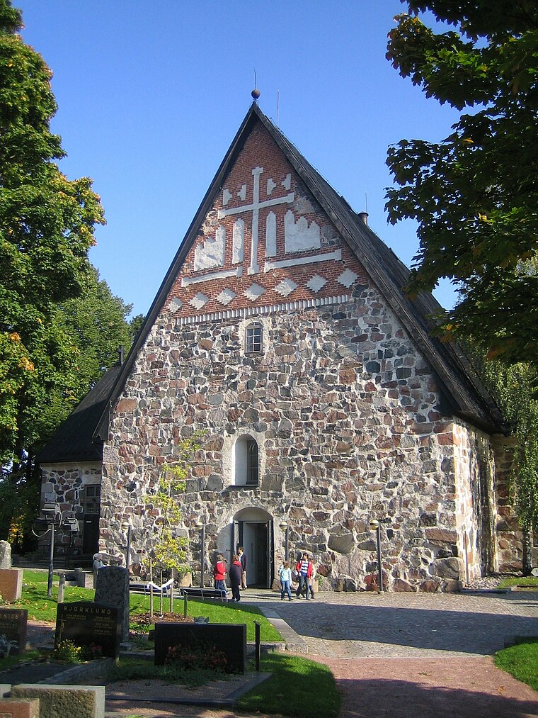
Photo: Tomisti, CC BY-SA 3.0.
Espoo Cathedral is a medieval parish church and cathedral in Espoo, Finland. It is the seat of the Evangelical Lutheran Diocese of Espoo, established in 2004. Espoo Cathedral is situated 1½ km south of Bembölen vanha mylly.
Espoo Hospital
Hospital

Photo: Boberger, CC BY-SA 4.0.
Espoo Hospital is situated 1¼ km east of Bembölen vanha mylly.
Places in the Area
Nearby places include Bemböle and Espoo.

Espoo

Photo: Danapit, CC BY-SA 3.0.
Espoo with a population of a quarter of a million is the second largest city in Finland. It's part of the Helsinki Metropolitan Area along with the cities of Helsinki, Vantaa, and the small city of Kauniainen which is completely encircled by Espoo.
Espoon keskus
Suburb

Photo: JKorpimies, CC BY-SA 4.0.
Espoon keskus is the central district of Espoo, the second biggest city of Finland and the administrative centre with the city hall of Espoo. The areas of Kiltakallio, Kirkkojärvi, Saarniraivio, Suna, Suvela and Tuomarila belong to Espoon keskus.
Bembölen vanha mylly
- Type: Ruins
- Category: historic site
- Location: Uusimaa, Southern Finland, Finland, Nordic countries, Europe
- View on OpenStreetMap
Latitude
60.22393° or 60° 13′ 26″ northLongitude
24.66212° or 24° 39′ 44″ eastOpen location code
9GG66MF6+HROpenStreetMap ID
way 1300572891OpenStreetMap feature
historic=ruins
This page is based on OpenStreetMap, Wikidata, and Wikimedia Commons.
We’d love your help improving our open data sources. Thank you for contributing.
Satellite Map
Discover Bembölen vanha mylly from above in high-definition satellite imagery.
Notable Places Nearby
Highlights include Keski-Espoon purohyrrä and Bembölen vanha mylly.
Nearby Places
Explore places such as Ylämyllyntie and Motonet.
Uusimaa: Must-Visit Destinations
Delve into Helsinki, Espoo, Vantaa, and Porvoo.
Curious Ruins to Discover
Uncover intriguing ruins from every corner of the globe.
About Mapcarta. Data © OpenStreetMap contributors and available under the Open Database License". Text is available under the CC BY-SA 4.0 license, except for photos, directions, and the map. Photo: Danapit, CC BY-SA 3.0.