Le Roc del Rey
Le Roc del Rey is a campsite in Belloc, Arrondissement of Pamiers, Occitanie. Le Roc del Rey is situated nearby to the peak Pech Maure, as well as near the town hall Mairie de Belloc.| Tap on a place to explore it |
Places of Interest Nearby
Highlights include Église de l’Exaltation-de-la-Sainte-Croix de Belloc and Église de Queille.
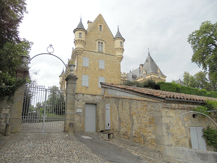
Église de l’Exaltation-de-la-Sainte-Croix de Belloc
Church

Photo: LucasD, CC BY-SA 4.0.
Église de l’Exaltation-de-la-Sainte-Croix de Belloc is a church, which is situated 670 metres east of Le Roc del Rey.
Église de Queille
Church

Photo: BLUMJ, CC BY-SA 3.0.
Église de Queille is a church, which is situated 1½ km north of Le Roc del Rey.
Château de Léran
Castle
 Château de Léran is a castle, which is situated 2½ km southwest of Le Roc del Rey.
Places in the Area
Nearby places include Troye-d’Ariège and Aigues-Vives.
Troye-d’Ariège
Village

Photo: Jcb-caz-11, CC BY-SA 4.0.
Troye-d'Ariège is a commune in the Ariège department in southwestern France. Troye-d’Ariège is situated 4 km northwest of Le Roc del Rey.
Aigues-Vives
Village

Photo: Poppy, CC BY-SA 3.0.
Aigues-Vives is a commune in the Ariège department in the Occitanie region of southwestern France. The inhabitants of the commune are known as Aigues-Vivesiens or Aigues-Vivesiennes. Aigues-Vives is situated 4½ km southwest of Le Roc del Rey.
Le Peyrat
Village

Photo: Jcb-caz-11, CC BY-SA 4.0.
Le Peyrat is a commune in the Ariège department in southwestern France. Le Peyrat is situated 6 km south of Le Roc del Rey.
Le Roc del Rey
- Type: Campsite
- Address: Belloc, 09600
- Categories: tourism and camping
- Location: Belloc, Arrondissement of Pamiers, Ariège, Occitanie, France, Europe
- View on OpenStreetMap
Latitude
43.01182° or 43° 0′ 43″ northLongitude
1.92395° or 1° 55′ 26″ eastOperator
Le Roc del ReyOpen location code
8FM32W6F+PHOpenStreetMap ID
way 1305552807OpenStreetMap feature
tourism=camp_site
This page is based on OpenStreetMap, Wikidata, and Wikimedia Commons.
We’d love your help improving our open data sources. Thank you for contributing.
Satellite Map
Discover Le Roc del Rey from above in high-definition satellite imagery.
Notable Places Nearby
Highlights include Pech Maure and Mairie de Belloc.
Nearby Places
Explore places such as Picnic and La Jasse.
Occitanie: Must-Visit Destinations
Delve into Haute-Garonne, Toulouse, Montpellier, and Aveyron.
Curious Campsites to Discover
Uncover intriguing campsites from every corner of the globe.
About Mapcarta. Data © OpenStreetMap contributors and available under the Open Database License". Text is available under the CC BY-SA 4.0 license, except for photos, directions, and the map. Photo: Pafmax, CC BY-SA 3.0.