Markus-Bau
Markus-Bau is an office building in Bochum, Arnsberg, North Rhine-Westphalia which is located on Borgmannstraße. Markus-Bau is situated nearby to the church Martin-Luther-King-Haus, as well as near the farm Kornkammer Haus Holte.| Tap on a place to explore it |
Places of Interest Nearby
Highlights include Volksgarten Lütgendortmund and St. Magdalena, Lütgendortmund.
Volksgarten Lütgendortmund
Park

Photo: A.Savin, CC BY-SA 3.0.
Volksgarten Lütgendortmund is a park, which is situated 1¼ km east of Markus-Bau.
St. Magdalena, Lütgendortmund
Church
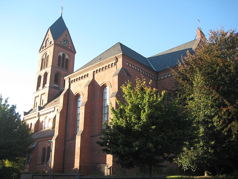
Photo: Die Singularität, CC BY-SA 3.0.
St. Magdalena, Lütgendortmund is a church, which is situated 1¼ km east of Markus-Bau.
Dortmund-Lütgendortmund station
Railway stop

Photo: Platte, CC BY-SA 4.0.
Dortmund-Lütgendortmund station is a single-track, underground terminal station in the city of Dortmund in the German state of North Rhine-Westphalia. The platform is accessible by stairs, escalator or lift. Dortmund-Lütgendortmund station is situated 1½ km east of Markus-Bau.
Places in the Area
Nearby places include Bochum-Werne and Kolonie Landwehr.
Bochum-Werne
Suburb
Bochum-Werne is a district of the city of Bochum in the Ruhr area in North Rhine-Westphalia in Germany. Werne is in the East of Bochum, North of Langendreer. Werne borders the city of Dortmund.

Gerthe
Suburb
Gerthe is a part of the city of Bochum in the Ruhr area in Germany. Up to the 19th century Westphalian was spoken here. Gerthe is a district in the working-class north of Bochum, in the northeast, bordering Herne and Castrop-Rauxel. Gerthe is situated 2½ km northwest of Markus-Bau.
Markus-Bau
- Type: Office building
- Address: Borgmannstraße 2, Bochum, 44894
- Categories: building, office, and business
- Location: Bochum, Arnsberg, Ruhr, North Rhine-Westphalia, Germany, Central Europe, Europe
- View on OpenStreetMap
Latitude
51.5037° or 51° 30′ 13″ northLongitude
7.31423° or 7° 18′ 51″ eastOpen location code
9F39G837+FMOpenStreetMap ID
way 1307178324OpenStreetMap feature
building=officeOpenStreetMap feature
office=company
This page is based on OpenStreetMap, Wikidata, and Wikimedia Commons.
We’d love your help improving our open data sources. Thank you for contributing.
Satellite Map
Discover Markus-Bau from above in high-definition satellite imagery.
Notable Places Nearby
Highlights include Martin-Luther-King-Haus and Kornkammer Haus Holte.
Nearby Places
Explore places such as Limbeckstraße and Holte-Kreta Gyros Grill.
Ruhr: Must-Visit Destinations
Delve into Dortmund, Essen, Duisburg, and Gelsenkirchen.
Curious Office Buildings to Discover
Uncover intriguing office buildings from every corner of the globe.
About Mapcarta. Data © OpenStreetMap contributors and available under the Open Database License". Text is available under the CC BY-SA 4.0 license, except for photos, directions, and the map. Photo: NatiSythen, Public domain.