Stellplatz Seepark Augstbord
Stellplatz Seepark Augstbord is a motorhome stopover in Valais, Switzerland. Stellplatz Seepark Augstbord is situated nearby to Holy Trinity church, as well as near the government office Gemeindekanzlei.| Tap on a place to explore it |
Places of Interest Nearby
Highlights include Medieval castle ruins stone house and the ruins of a Zwingherren castle and Holy Trinity church.
Medieval castle ruins stone house and the ruins of a Zwingherren castle
Castle
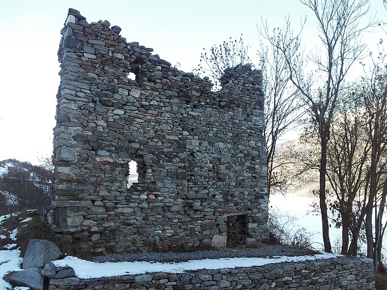
Photo: Amagra lacroix, CC BY-SA 3.0.
Medieval castle ruins stone house and the ruins of a Zwingherren castle is situated 450 metres northwest of Stellplatz Seepark Augstbord.
Holy Trinity church
Church

Photo: Wikimedia, CC BY-SA 3.0.
Holy Trinity church is situated 430 metres south of Stellplatz Seepark Augstbord.
Raron railway station
Railway station

Photo: Litzler, Public domain.
Raron railway station is a railway station in the municipality of Raron, in the Swiss canton of Valais. It is an intermediate stop on the Simplon line and is served by local trains only. Raron railway station is situated 2 km north of Stellplatz Seepark Augstbord.
Places in the Area
Nearby places include Bürchen and Raron.
Bürchen
Village

Photo: Daniel Reust, CC BY 4.0.
Bürchen is a municipality in the district of Raron in the German-speaking part of the canton of Valais in Switzerland.
Raron
Village

Photo: Berger, CC BY-SA 3.0.
Raron is a municipality in the district of Raron in the canton of Valais in Switzerland.
Moosalp
Locality

Photo: Daniel Reust, CC BY-SA 4.0.
The Moosalp is a high mountain pass across the western Pennine Alps, connecting Bürchen with Törbel in the canton of Valais in Switzerland. The pass lies north-east of Augstbordhorn. Moosalp is situated 4½ km southeast of Stellplatz Seepark Augstbord.
Stellplatz Seepark Augstbord
- Type: Motorhome stopover
- Categories: tourism and transportation
- Location: Valais, Switzerland, Central Europe, Europe
- View on OpenStreetMap
Latitude
46.28866° or 46° 17′ 19″ northLongitude
7.80145° or 7° 48′ 5″ eastOperator
Unterbäch TourismusOpen location code
8FR97RQ2+FHOpenStreetMap ID
way 1308278140OpenStreetMap feature
tourism=caravan_site
This page is based on OpenStreetMap, Wikidata, and Wikimedia Commons.
We’d love your help improving our open data sources. Thank you for contributing.
Satellite Map
Discover Stellplatz Seepark Augstbord from above in high-definition satellite imagery.
Notable Places Nearby
Highlights include Stellplatz Seepark Augstbord and Seepark Augstbord.
Nearby Places
Explore places such as Schwarzhorn and Nesthorn.
Valais: Must-Visit Destinations
Delve into Sion, Zermatt, Martigny, and Brig.
Curious Motorhome Stopovers to Discover
Uncover intriguing motorhome stopovers from every corner of the globe.
About Mapcarta. Data © OpenStreetMap contributors and available under the Open Database License". Text is available under the CC BY-SA 4.0 license, except for photos, directions, and the map. Photo: Debugman, CC BY 3.0.