Complexe sportif de Saint-Côme
Complexe sportif de Saint-Côme is a sports venue in Salon-de-Provence, Arrondissement of Aix-en-Provence, Provence-Alpes-Côte d’Azur. Complexe sportif de Saint-Côme is situated nearby to the pitch Stade Saint-Côme, as well as near the park Square Docteur François Blanc.| Tap on a place to explore it |
Places of Interest Nearby
Highlights include Porte de l’Horloge de Salon-de-Provence and Nostradamus house.
Porte de l’Horloge de Salon-de-Provence
City gate

Photo: Hawobo, CC BY-SA 2.0 de.
Porte de l’Horloge de Salon-de-Provence is a city gate, which is situated 630 metres southwest of Complexe sportif de Saint-Côme.
Nostradamus house
Museum

Photo: Paul Hermans, CC BY-SA 4.0.
Nostradamus house is a museum, which is situated 620 metres southwest of Complexe sportif de Saint-Côme.
Collégiale Saint-Laurent de Salon-de-Provence
Church
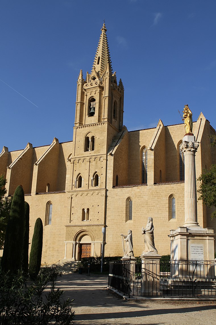
Photo: Okki, CC BY-SA 3.0.
Collégiale Saint-Laurent de Salon-de-Provence is a church, which is situated 540 metres west of Complexe sportif de Saint-Côme.
Places in the Area
Nearby places include La Monaque and Pélissanne.

Pélissanne
Town

Photo: Okki, CC BY-SA 3.0.
Pélissanne is a commune in the Bouches-du-Rhône department in the Provence-Alpes-Côte d'Azur region in Southern France. It is located just east of Salon-de-Provence, within the Aix-Marseille-Provence Metropolis. Pélissanne is situated 4 km east of Complexe sportif de Saint-Côme.
Grans
Village

Photo: Alexandre Morvan, CC BY-SA 3.0.
Grans is a commune in the Bouches-du-Rhône department in the Provence-Alpes-Côte d'Azur region in Southern France. Grans is situated 5 km southwest of Complexe sportif de Saint-Côme.
Complexe sportif de Saint-Côme
- Type: Sports venue
- Categories: recreation area and sports location
- Location: Salon-de-Provence, Arrondissement of Aix-en-Provence, Bouches-du-Rhône, Provence-Alpes-Côte d’Azur, France, Europe
- View on OpenStreetMap
Latitude
43.64429° or 43° 38′ 39″ northLongitude
5.10372° or 5° 6′ 13″ eastOpen location code
8FM7J4V3+PFOpenStreetMap ID
way 1308453633OpenStreetMap feature
leisure=sports_centre
This page is based on OpenStreetMap, Wikidata, and Wikimedia Commons.
We’d love your help improving our open data sources. Thank you for contributing.
Satellite Map
Discover Complexe sportif de Saint-Côme from above in high-definition satellite imagery.
Notable Places Nearby
Highlights include Stade Saint-Côme and Square Docteur François Blanc.
Nearby Places
Explore places such as Saint-Côme and Saint-Côme.
Bouches-du-Rhône: Must-Visit Destinations
Delve into Marseille, Aix-en-Provence, Arles, and La Ciotat.
Curious Sports Venues to Discover
Uncover intriguing sports venues from every corner of the globe.
About Mapcarta. Data © OpenStreetMap contributors and available under the Open Database License". Text is available under the CC BY-SA 4.0 license, except for photos, directions, and the map. Photo: Okki, CC BY-SA 3.0.