ZA de Kergonidec
ZA de Kergonidec is in Landerneau, Arrondissement de Brest, Brittany. ZA de Kergonidec is situated nearby to the fire station Centre d’incendie et de secours de Landerneau, as well as near the health club L’Orange Bleue.| Tap on a place to explore it |
Places of Interest Nearby
Highlights include Landerneau station and Keranden manor.
Landerneau station
Railway station
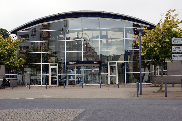
Photo: Quoique, CC BY-SA 3.0.
Landerneau station is a French railway station serving the town Landerneau, Finistère department, in western France. It is situated on the Paris–Brest railway and the branch to Quimper. Landerneau station is situated 1½ km southeast of ZA de Kergonidec.
Keranden manor
Castle

Photo: Fab5669, CC BY-SA 4.0.
Keranden manor is a castle, which is situated 1½ km southeast of ZA de Kergonidec.
Landerneau Cemetery
Cemetery

Photo: Romainbehar, CC0.
Landerneau Cemetery is situated 1½ km southeast of ZA de Kergonidec.
Places in the Area
Nearby places include Landerneau and Chapelle Notre-Dame du Rhun.
Landerneau
Town

Photo: Fab5669, CC BY-SA 4.0.
Landerneau is a commune in the Finistère department of Brittany in north-western France. It lies at the mouth of the Elorn River which divides the Breton provinces of Cornouaille and Léon, 22 km east of Brest.
Chapelle Notre-Dame du Rhun
Hamlet

Photo: Moreau.henri, CC BY-SA 3.0.
Chapelle Notre-Dame du Rhun is a hamlet, which is situated 10 km west of ZA de Kergonidec.
ZA de Kergonidec
- Type: Industry
- Location: Landerneau, Arrondissement de Brest, Finistère, Brittany, France, Europe
- View on OpenStreetMap
Latitude
48.46391° or 48° 27′ 50″ northLongitude
-4.27186° or 4° 16′ 19″ westOpen location code
8CWQFP7H+H7OpenStreetMap ID
way 130855006OpenStreetMap feature
landuse=industrial
This page is based on OpenStreetMap, Wikidata, and Wikimedia Commons.
We’d love your help improving our open data sources. Thank you for contributing.
Satellite Map
Discover ZA de Kergonidec from above in high-definition satellite imagery.
Notable Places Nearby
Highlights include Centre d’incendie et de secours de Landerneau and L’Orange Bleue.
Nearby Places
Explore places such as Magasin Vert and Renault.
Brittany: Must-Visit Destinations
Delve into Rennes, Brest, Finistère, and Morbihan.
Curious Places to Discover
Uncover intriguing places from every corner of the globe.
About Mapcarta. Data © OpenStreetMap contributors and available under the Open Database License". Text is available under the CC BY-SA 4.0 license, except for photos, directions, and the map. Photo: Spendeau, CC BY-SA 3.0.