München-Pasing Haberlandstraße 9
München-Pasing Haberlandstraße 9 is a playground in Munich, Upper Bavaria, Bavaria. München-Pasing Haberlandstraße 9 is situated nearby to the sports venue Tennis Pasing, as well as near the church Himmelfahrtskirche.| Tap on a place to explore it |
Places of Interest Nearby
Highlights include München-Pasing station and Himmelfahrtskirche.
München-Pasing station
Railway station
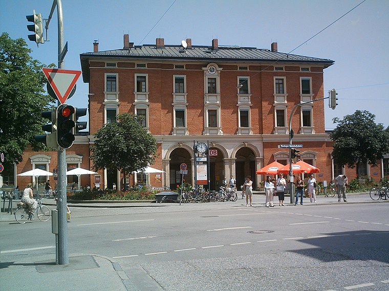
Photo: Rdb, CC BY-SA 3.0.
Munich-Pasing is a railway station in the west of Munich. It is the third-largest station in the city, after München Hauptbahnhof and München Ost. München-Pasing station is situated 610 metres east of München-Pasing Haberlandstraße 9.
Himmelfahrtskirche
Church

Photo: AHert, CC BY-SA 3.0.
Himmelfahrtskirche is a church, which is situated 300 metres north of München-Pasing Haberlandstraße 9.
Kanalwärterhäuschen (Pasing)
Historic building

Photo: AHert, CC BY-SA 3.0.
Kanalwärterhäuschen (Pasing) is a historic building, which is situated 420 metres southeast of München-Pasing Haberlandstraße 9.
Places in the Area
Nearby places include Villenkolonie Pasing II and Pasing.
Villenkolonie Pasing II
Neighborhood
The Villenkolonie Pasing II is a single-family home colony in Munich-Pasing. It was built according to the model of a garden town.
Pasing
Suburb
Photo: Rdb, CC BY-SA 3.0.
Pasing is a district in the city of Munich, Germany, and part of the borough Pasing-Obermenzing.
Villenkolonie Pasing I
Neighborhood
The Villenkolonie Pasing I is a single-family house colony in Munich-Pasing.
München-Pasing Haberlandstraße 9
- Type: Playground
- Category: recreation area
- Location: Munich, Upper Bavaria, Bavaria, Germany, Central Europe, Europe
- View on OpenStreetMap
Latitude
48.15065° or 48° 9′ 2″ northLongitude
11.45364° or 11° 27′ 13″ eastOperator
Oberbayerische Heimstätte, Gemeinnützige Siedlungsgesellschaft mbHOpen location code
8FWH5F23+7FOpenStreetMap ID
way 1311618848OpenStreetMap feature
leisure=playground
This page is based on OpenStreetMap, Wikidata, and Wikimedia Commons.
We’d love your help improving our open data sources. Thank you for contributing.
Satellite Map
Discover München-Pasing Haberlandstraße 9 from above in high-definition satellite imagery.
Notable Places Nearby
Highlights include München-Pasing Haberlandstraße 9 and Tennis Pasing.
Nearby Places
Explore places such as Volmstraße and Volmstraße.
Munich: Must-Visit Destinations
Delve into North Munich, Altstadt, Haidhausen, and Ludwigsvorstadt-Isarvorstadt.
Curious Playgrounds to Discover
Uncover intriguing playgrounds from every corner of the globe.
About Mapcarta. Data © OpenStreetMap contributors and available under the Open Database License". Text is available under the CC BY-SA 4.0 license, except for photos, directions, and the map. Photo: Heav84, CC BY-SA 3.0.