Les Minoteries
Les Minoteries is an apartment building in Rennes, Ille-et-Vilaine, Brittany. Les Minoteries is situated nearby to the social service facility Ehpad Léon Grimault, as well as near the theater building La Paillette.| Tap on a place to explore it |
Places of Interest Nearby
Highlights include Jardin de la Confluence and Église Sainte-Anne de Rennes.
Jardin de la Confluence
Park

Photo: Lektz, CC BY-SA 4.0.
Jardin de la Confluence is a park, which is situated 220 metres southeast of Les Minoteries.
Église Sainte-Anne de Rennes
Church
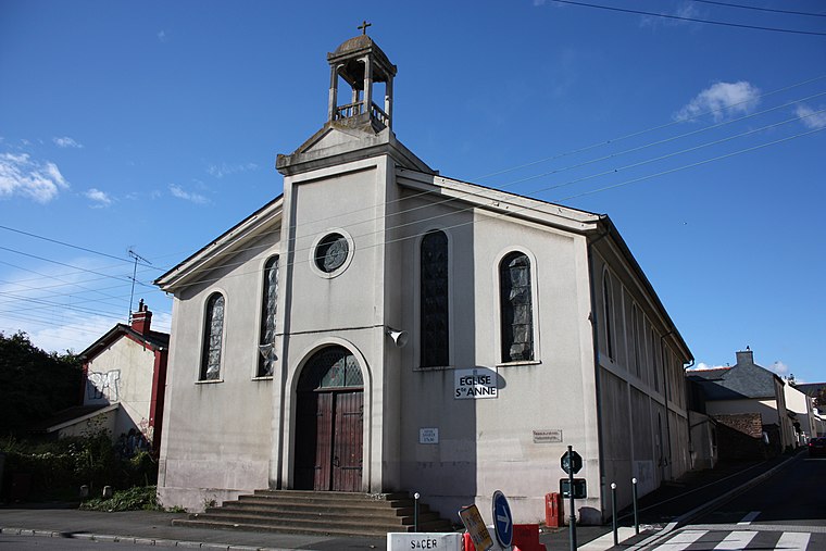
Photo: JulienBalas, CC BY-SA 3.0.
Église Sainte-Anne de Rennes is a church, which is situated 220 metres southwest of Les Minoteries.
Roazhon Park
Sports venue

Photo: Kuso, Public domain.
Roazhon Park is a football stadium in Rennes, Brittany, France. Roazhon or is the Breton name of Rennes. The stadium was inaugurated on 15 September 1912. Roazhon Park is situated 1 km west of Les Minoteries.
Places in the Area
Nearby places include Saint-Jacques-de-la-Lande and Chantepie.
Saint-Jacques-de-la-Lande
Town

Photo: Pymouss, CC BY-SA 4.0.
Saint-Jacques-de-la-Lande is a commune of Rennes Métropole in the Ille-et-Vilaine department of Brittany in northwestern France. Saint-Jacques-de-la-Lande is situated 3½ km south of Les Minoteries.
Chantepie
Town

Photo: DUMOUCH, CC BY-SA 3.0.
Chantepie is a commune of Rennes Métropole located in the Ille-et-Vilaine department in Brittany in northwestern France. Chantepie is situated 7 km east of Les Minoteries.
Pacé
Town

Photo: Pymouss44, CC BY-SA 3.0.
Pacé is a commune in the Ille-et-Vilaine department of Brittany in northwestern France. Pacé is situated 7 km northwest of Les Minoteries.
Les Minoteries
- Type: Apartment building
- Categories: building and residential building
- Location: Rennes, Arrondissement of Rennes, Ille-et-Vilaine, Brittany, France, Europe
- View on OpenStreetMap
Latitude
48.10954° or 48° 6′ 34″ northLongitude
-1.69862° or 1° 41′ 55″ westOpen location code
8CWW4852+RHOpenStreetMap ID
way 1311742227OpenStreetMap feature
building=apartments
This page is based on OpenStreetMap, Wikidata, and Wikimedia Commons.
We’d love your help improving our open data sources. Thank you for contributing.
Satellite Map
Discover Les Minoteries from above in high-definition satellite imagery.
Places with the Same Name
Discover other places named “Les Minoteries”.
Notable Places Nearby
Highlights include Ehpad Léon Grimault and La Paillette.
Nearby Places
Explore places such as Guilloux and Guilloux.
Brittany: Must-Visit Destinations
Delve into Brest, Finistère, Morbihan, and Ille-et-Vilaine.
Curious Apartment Buildings to Discover
Uncover intriguing apartment buildings from every corner of the globe.
About Mapcarta. Data © OpenStreetMap contributors and available under the Open Database License". Text is available under the CC BY-SA 4.0 license, except for photos, directions, and the map. Photo: Inkey, CC BY-SA 3.0.