Urbanización Jardines Golf
Urbanización Jardines Golf is a residential area in Andalusia, Spain. Urbanización Jardines Golf is situated nearby to the playground Parque Infantil Puerto Deportivo, as well as near the village green Glorieta Varadero.| Tap on a place to explore it |
Places of Interest Nearby
Highlights include Hospital Punta de Europa and Parque de las Acacias de Algeciras.
Hospital Punta de Europa
Hospital

Photo: Falconaumanni, CC BY-SA 4.0.
Hospital Punta de Europa is situated 480 metres south of Urbanización Jardines Golf.
Parque de las Acacias de Algeciras
Park

Photo: Falconaumanni, CC BY-SA 3.0.
Parque de las Acacias de Algeciras is a park in Algeciras, southeastern Spain. Established in 1975, it covers an area of 19,300 square metres. The Museo municipal de Algeciras lies to the north and Villa Smith lies in the southern part of the park.
Fuerte de Isla Verde

Photo: Falconaumanni, CC BY-SA 3.0.
Fuerte de Isla Verde was a military installation formerly located in Algeciras, Spain. It occupied the Isla Verde, which gave its name to the city as a whole. Fuerte de Isla Verde is situated 1¼ km northeast of Urbanización Jardines Golf.
Places in the Area
Nearby places include Algeciras and El Pelayo.
Algeciras

Photo: Falconaumanni, CC BY 3.0.
Algeciras is a city in the Andalucia region of southwestern Spain. Most travellers come to Algeciras for its numerous ferry connections to Morocco and don't spend more than a few hours in the city. A shame, given the town's quiet charm.
El Pelayo
Hamlet
El Pelayo or Pelayo is a village in the municipality of Algeciras in the Province of Cadiz in southeastern Spain, It is located 7 miles southwest from the city centre, along the main road to the southern tip of Spain at Tarifa, which is 14 kilometres away. El Pelayo is situated 6 km southwest of Urbanización Jardines Golf.
Palmones
Village
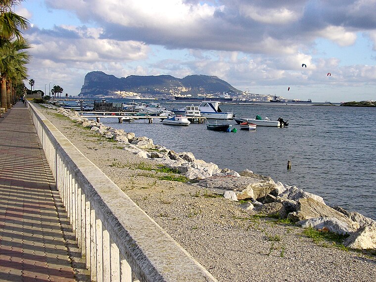
Photo: Falconaumanni, CC BY-SA 4.0.
Palmones is a village on the Bay of Gibraltar between Algeciras and La Linea de la Concepcion in the Province of Cádiz in Spain. The San Roque Refinery and Los Barrios commercial centre lie on either side of the town. Palmones is situated 7 km north of Urbanización Jardines Golf.
Urbanización Jardines Golf
- Type: Residential area
- Location: Andalusia, Spain, Iberia, Europe
- View on OpenStreetMap
Latitude
36.11491° or 36° 6′ 54″ northLongitude
-5.44189° or 5° 26′ 31″ westOpen location code
8C8P4H75+X6OpenStreetMap ID
way 1312203988OpenStreetMap feature
landuse=residential
This page is based on OpenStreetMap, Wikidata, and Wikimedia Commons.
We’d love your help improving our open data sources. Thank you for contributing.
Satellite Map
Discover Urbanización Jardines Golf from above in high-definition satellite imagery.
Notable Places Nearby
Highlights include Parque Infantil Puerto Deportivo and Glorieta Varadero.
Nearby Places
Explore places such as El Jamón and Av. Carlos Cano - Olivo.
Andalusia: Must-Visit Destinations
Delve into Seville, Granada, Málaga, and Córdoba.
Curious Residential Areas to Discover
Uncover intriguing residential areas from every corner of the globe.
About Mapcarta. Data © OpenStreetMap contributors and available under the Open Database License". Text is available under the CC BY-SA 4.0 license, except for photos, directions, and the map. Photo: sidibousaid, CC BY 2.0.