Charles River Bridge
The Charles River Bridge, referred to by the MBTA as Draw One, is a pair of railroad single-leaf, through-truss, rolling bascule bridges across the Charles River in Boston, Massachusetts, that connects North Station to MBTA Commuter Rail lines serving areas to the north.| Tap on a place to explore it |
Photo: Wikimedia, Public domain.
- Opening hours: 24/7
- Type: Bridge
- Description: Railway bridge
- Also known as: “Draw One”
Places of Interest Nearby
Highlights include TD Garden and Leverett Circle Connector Bridge.
TD Garden
Stadium
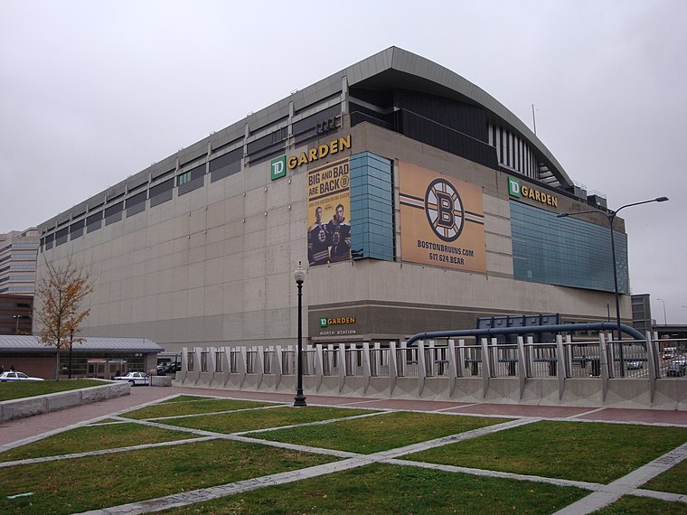
Photo: Nywalton, Public domain.
TD Garden is a multi-purpose arena in Boston. It is located directly above the MBTA's North Station, and it replaced the original Boston Garden upon opening in 1995. TD Garden is situated 1,300 feet southeast of Charles River Bridge.
Leverett Circle Connector Bridge
Bridge

Photo: Wikimedia, CC BY-SA 2.0.
The Leverett Circle Connector Bridge is a 1.7 mile-long highway bridge over the Charles River in Boston, Massachusetts, carrying two lanes each of northbound and southbound traffic.
USS Constitution
Museum

Photo: Wikimedia, Public domain.
USS Constitution, also known as Old Ironsides, is a three-masted wooden-hulled heavy frigate of the United States Navy. She is the world's oldest commissioned naval warship still afloat. USS Constitution is situated 2,700 feet northeast of Charles River Bridge.
Places in the Area
Nearby places include West End and North End.
West End
Suburb

Photo: RawheaD Rex, CC BY-SA 2.0.
The West End is a neighborhood of Boston, Massachusetts, United States, bounded generally by Cambridge Street to the south, the Charles River to the west and northwest, North Washington Street on the north and northeast, and New Sudbury Street on the east.
North End

Photo: Rellimaz, CC BY-SA 3.0.
Known as "Little Italy" for over a hundred years, the North End proudly carries the torch of Boston's Italian heritage. Its narrow, dense streets consistently draw hordes of visitors looking to experience old world culture and first class dining.
Charlestown

Photo: Traveler100, CC BY-SA 3.0.
Boston's Charlestown was the traditional home of employees at the now-decommissioned Navy Yard. It has experienced a shift in its population and industry and an increasing number of young professionals are joining the families who have lived in the area for years.
Charles River Bridge
- Categories: truss bridge, railway bridge, and transportation
- Location: Middlesex, Massachusetts, New England, United States, North America
- View on OpenStreetMap
Latitude
42.369° or 42° 22′ 8″ northLongitude
-71.06534° or 71° 3′ 55″ westInception
1931Operator
MBTAOpen location code
87JC9W9M+JVOpenStreetMap ID
way 1316059611OpenStreetMap feature
man_made=bridgeWikidata ID
Q267924
This page is based on OpenStreetMap, Wikidata, Wikimedia Commons, and Wikipedia.
We’d love your help improving our open data sources. Thank you for contributing.
Satellite Map
Discover Charles River Bridge from above in high-definition satellite imagery.
In Other Languages
“Charles River Bridge” goes by many names.
- Chinese: “查尔斯河通勤列车钓桥”
- Chinese: “查爾斯河通勤列車釣橋”
Notable Places Nearby
Highlights include Charles River Bridge and Charles River Bridge.
Nearby Places
Explore places such as Boston & Maine Railroad Signal Tower A and Duck Boat Ramp.
Massachusetts: Must-Visit Destinations
Delve into Boston, Cambridge, Springfield, and Downtown Boston.
Curious Bridges to Discover
Uncover intriguing bridges from every corner of the globe.
About Mapcarta. Data © OpenStreetMap contributors and available under the Open Database License". Text is available under the CC BY-SA 4.0 license, except for photos, directions, and the map. Description text is based on the Wikipedia page “Charles River Bridge”. Photo: Wikimedia, Public domain.