Linden Banquet Hall
Linden Banquet Hall is an event venue in Champaign, Illinois. Linden Banquet Hall is situated nearby to the sports venue Bill Seeber Memorial Soccer Complex, as well as near Rantoul United Pentecostal Church.| Tap on a place to explore it |
Places of Interest Nearby
Highlights include Rantoul National Aviation Center and Rantoul station.
Rantoul National Aviation Center
Aerodrome
Rantoul National Aviation Center, also known as Frank Elliott Field, is a public use airport located in Rantoul, a village in Champaign County, Illinois, United States.
Rantoul station
Railway station
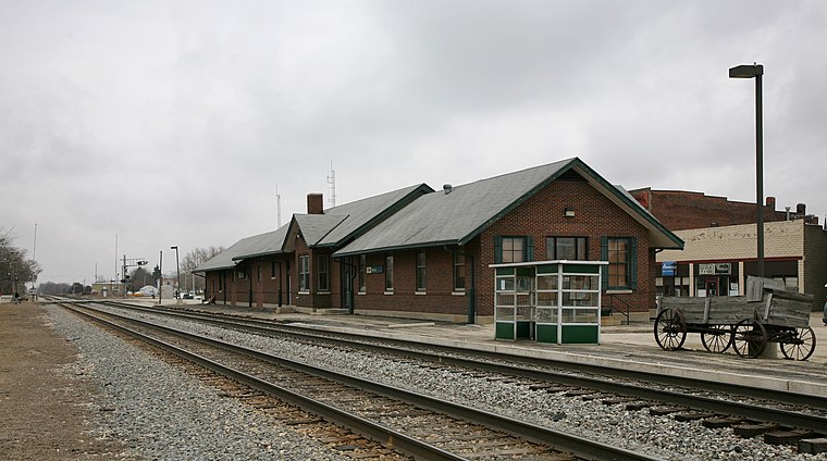
Photo: Dschwen, CC BY-SA 4.0.
Rantoul station is an Amtrak intercity train station in Rantoul, Illinois, United States, on their Illini and Saluki service. It was originally built by the Illinois Central Railroad. The City of New Orleans also uses these tracks, but does not stop. Rantoul station is situated 1½ miles north of Linden Banquet Hall.
Places in the Area
Nearby places include Rantoul and Thomasboro.
Rantoul

Photo: Dschwen, CC BY-SA 4.0.
Rantoul is a village in northern Champaign County, Illinois, United States. The population was 12,371 at the 2020 census. It is part of the Champaign–Urbana metropolitan area.
Thomasboro
Village

Photo: Dschwen, CC BY-SA 4.0.
Thomasboro is a village in Champaign County, Illinois, United States. The population was 1,034 at the 2020 census. The village has the name of John Thomas, a pioneer settler. Thomasboro is situated 3½ miles south of Linden Banquet Hall.
Linden Banquet Hall
- Type: Event venue
- Category: building
- Location: Champaign, Illinois, Midwest, United States, North America
- View on OpenStreetMap
Latitude
40.28933° or 40° 17′ 22″ northLongitude
-88.16308° or 88° 9′ 47″ westLevels
1Open location code
86GH7RQP+PQOpenStreetMap ID
way 1318192637OpenStreetMap feature
amenity=events_venueOpenStreetMap feature
building=yes
This page is based on OpenStreetMap, Wikidata, and Wikimedia Commons.
We’d love your help improving our open data sources. Thank you for contributing.
Satellite Map
Discover Linden Banquet Hall from above in high-definition satellite imagery.
Notable Places Nearby
Highlights include Bill Seeber Memorial Soccer Complex and Rantoul United Pentecostal Church.
Nearby Places
Explore places such as Quarters Inn & Suites and Little Wings Childcare.
Illinois: Must-Visit Destinations
Delve into Chicago, Springfield, Rockford, and Loop.
Curious Event Venues to Discover
Uncover intriguing event venues from every corner of the globe.
About Mapcarta. Data © OpenStreetMap contributors and available under the Open Database License". Text is available under the CC BY-SA 4.0 license, except for photos, directions, and the map. Photo: Rastapopulous, CC BY-SA 3.0.