Pont de Jassans
Pont de Jassans is a bridge in Beauregard, Arrondissement of Bourg-en-Bresse, Auvergne-Rhône-Alpes. Pont de Jassans is situated nearby to the pitch City stade, as well as near the river La Saône.| Tap on a place to explore it |
Places of Interest Nearby
Highlights include Château de Beauregard and Église Saint-François-d’Assise de Beauregard.
Château de Beauregard
Castle
 Château de Beauregard is a castle, which is situated 590 metres northeast of Pont de Jassans.
Église Saint-François-d’Assise de Beauregard
Church
 Église Saint-François-d’Assise de Beauregard is a church, which is situated 510 metres northeast of Pont de Jassans.
Centre pénitentiaire de Villefranche-sur-Saône
Prison
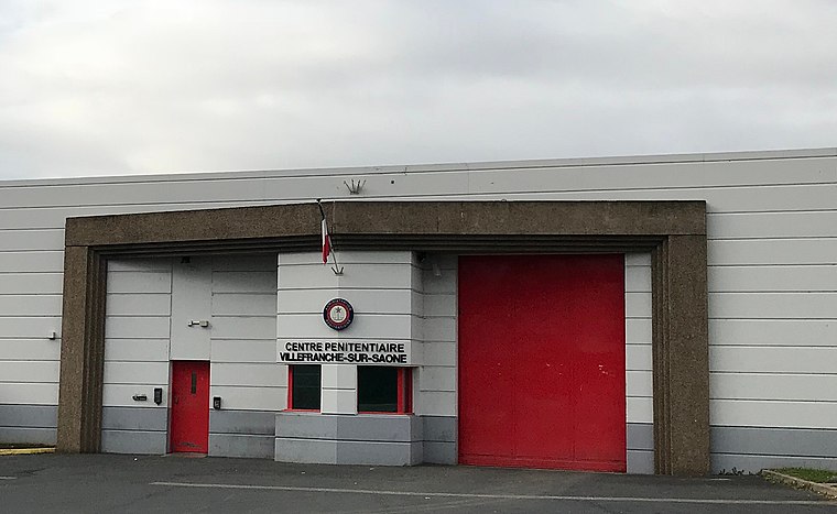 Centre pénitentiaire de Villefranche-sur-Saône is a prison, which is situated 2 km west of Pont de Jassans.
Places in the Area
Nearby places include Jassans-Riottier and Frans.
Jassans-Riottier
Village

Photo: Sebleouf, CC BY-SA 3.0.
Jassans-Riottier, known colloquially as Jassans, is a commune in the Ain department in eastern France.
Frans
Village

Photo: Sebleouf, CC BY-SA 3.0.
Frans, known colloquially as Frans-les-Vernes, is a commune in the Ain department in eastern France.
Villefranche-sur-Saône

Photo: Saturnyn, CC BY-SA 3.0.
Villefranche-sur-Saône is a town of 36,000 people in Greater Lyon. It is known for being the main city of the Beaujolais region.
Pont de Jassans
- Type: Bridge
- Category: transportation
- Location: Beauregard, Arrondissement of Bourg-en-Bresse, Ain, Auvergne-Rhône-Alpes, France, Europe
- View on OpenStreetMap
Latitude
45.99646° or 45° 59′ 47″ northLongitude
4.74967° or 4° 44′ 59″ eastOpen location code
8FQ6XPWX+HVOpenStreetMap ID
way 1326321468OpenStreetMap feature
man_made=bridge
This page is based on OpenStreetMap, Wikidata, and Wikimedia Commons.
We’d love your help improving our open data sources. Thank you for contributing.
Satellite Map
Discover Pont de Jassans from above in high-definition satellite imagery.
Notable Places Nearby
Highlights include City stade and La Saône.
Nearby Places
Explore places such as Les amis de la boule and Le lusitano.
Auvergne-Rhône-Alpes: Must-Visit Destinations
Delve into Lyon, Grenoble, Clermont-Ferrand, and Saint-Étienne.
Curious Bridges to Discover
Uncover intriguing bridges from every corner of the globe.
About Mapcarta. Data © OpenStreetMap contributors and available under the Open Database License". Text is available under the CC BY-SA 4.0 license, except for photos, directions, and the map. Photo: Inkey, CC BY-SA 3.0.