Pacific Shores
Pacific Shores is a residential area in Oak Bay, Capital Regional District, British Columbia which is located on Haultain Street. Pacific Shores is situated nearby to the church St. Patrick’s Parish, as well as near the health club barreMADE.| Tap on a place to explore it |
Places of Interest Nearby
Highlights include Royal Jubilee Hospital and Oak Bay High School.
Royal Jubilee Hospital
Hospital
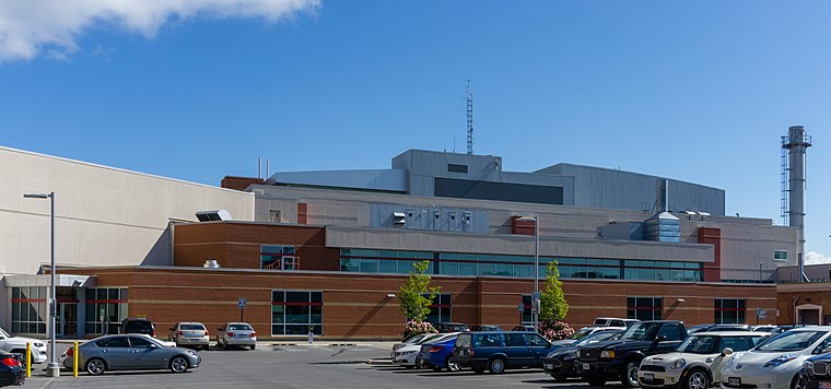
Photo: Podzemnik, CC BY-SA 4.0.
Royal Jubilee Hospital is a 500-bed general hospital in Victoria, British Columbia, Canada, located about 3 km east of the city centre, in the Jubilee neighbourhood. Royal Jubilee Hospital is situated 790 metres southwest of Pacific Shores.
Oak Bay High School
School

Photo: Architectsea, CC BY-SA 4.0.
École Secondaire Oak Bay High School is a high school in the Greater Victoria School District and is located in Oak Bay, British Columbia, Canada. The enrollment is approximately 1,400 students attending in grades 9 to 12 in both regular and French immersion programs. Oak Bay High School is situated 420 metres south of Pacific Shores.
Pemberton Memorial Operating Room
Museum

Photo: Wikimedia, Public domain.
The Pemberton Memorial Operating Room is a National Historic Site of Canada, the first operating room of the Royal Jubilee Hospital in Victoria, British Columbia. Pemberton Memorial Operating Room is situated 1 km west of Pacific Shores.
Places in the Area
Nearby places include Oak Bay and Uplands.
Oak Bay
Town

Photo: Wikimedia, CC BY-SA 2.0.
Victoria is the capital of Canada's westernmost province; British Columbia, near the southern tip of Vancouver Island. Victoria contains a perfect combination of the old and new Canada.
Uplands
Neighborhood
Uplands, Victoria is a 188.17-hectare neighbourhood located in the north east part of the District of Oak Bay, a suburb adjacent to Victoria, British Columbia, Canada, and situated between the neighbourhoods of Cadboro Bay and North Oak Bay.
Chinatown
Neighborhood

Photo: Podzemnik, CC BY-SA 4.0.
The Chinatown in Victoria, British Columbia is the oldest Chinatown in Canada and the second oldest in North America after San Francisco. Victoria's Chinatown had its beginnings in the mid-nineteenth century in the mass influx of miners from California to what is now British Columbia in 1858. Chinatown is situated 3½ km west of Pacific Shores.
Pacific Shores
- Type: Residential area
- Address: 2181 Haultain Street
- Location: Oak Bay, Capital Regional District, British Columbia, Canada, North America
- View on OpenStreetMap
Latitude
48.43565° or 48° 26′ 8″ northLongitude
-123.31744° or 123° 19′ 3″ westOpen location code
84WRCMPM+72OpenStreetMap ID
way 1327161915OpenStreetMap feature
landuse=residential
This page is based on OpenStreetMap, Wikidata, and Wikimedia Commons.
We’d love your help improving our open data sources. Thank you for contributing.
Satellite Map
Discover Pacific Shores from above in high-definition satellite imagery.
Places with the Same Name
Discover other places named “Pacific Shores”.
Notable Places Nearby
Highlights include St. Patrick’s Parish and barreMADE.
Nearby Places
Explore places such as Florence Apartments and Highlander.
British Columbia: Must-Visit Destinations
Delve into Vancouver, Victoria, North Vancouver, and City Centre.
Curious Residential Areas to Discover
Uncover intriguing residential areas from every corner of the globe.
About Mapcarta. Data © OpenStreetMap contributors and available under the Open Database License". Text is available under the CC BY-SA 4.0 license, except for photos, directions, and the map. Photo: Wikimedia, CC0.