Pou de la Mare de Déu del Carme
Pou de la Mare de Déu del Carme is a building in Onda, Castellón, Valencian Community. Pou de la Mare de Déu del Carme is situated nearby to the hill Farons, as well as near the peak la Talaia.| Tap on a place to explore it |
Places of Interest Nearby
Highlights include La Serratella and Onda Castle.
La Serratella
Stadium
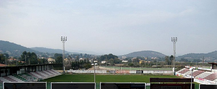 La Serratella is a stadium, which is situated 2 km south of Pou de la Mare de Déu del Carme.
Onda Castle
Castle

Photo: Enfo, CC BY-SA 3.0.
Onda Castle is situated 2½ km south of Pou de la Mare de Déu del Carme.
Ermita del Salvador
Church

Photo: Columbusalbus, CC BY-SA 3.0.
Ermita del Salvador is a church, which is situated 2½ km west of Pou de la Mare de Déu del Carme.
Places in the Area
Nearby places include Onda and Pont de Sonella.
Onda
Town

Photo: Columbusalbus, CC BY-SA 4.0.
Onda is a town in eastern Spain, in the province of Castelló, part of the autonomous community of Valencia. It has 24,859 inhabitants. The Sitjar dam, located close to Onda, is an important feature for the irrigation of the nearby fields with water from the Millars River.
Pont de Sonella
Locality

Photo: Joanbanjo, CC BY-SA 3.0.
Pont de Sonella is a locality, which is situated 3 km south of Pou de la Mare de Déu del Carme.
Ribesalbes
Village

Photo: Wikimedia, CC BY-SA 3.0.
Ribesalbes is a municipality located in the province of Castellón, Valencian Community, Spain. In 1780s, Joseph Ferrer founded an earthenware factory in Ribesalbes. Ribesalbes is situated 4½ km north of Pou de la Mare de Déu del Carme.
Pou de la Mare de Déu del Carme
- Type: Building
- Category: pumping station
- Location: Onda, Castellón, Valencian Community, Eastern Spain, Spain, Iberia, Europe
- View on OpenStreetMap
Latitude
39.98526° or 39° 59′ 7″ northLongitude
-0.26143° or 0° 15′ 41″ westOpen location code
8CFXXPPQ+4COpenStreetMap ID
way 1333033475OpenStreetMap feature
building=serviceOpenStreetMap feature
man_made=pumping_station
This page is based on OpenStreetMap, Wikidata, and Wikimedia Commons.
We’d love your help improving our open data sources. Thank you for contributing.
Satellite Map
Discover Pou de la Mare de Déu del Carme from above in high-definition satellite imagery.
Notable Places Nearby
Highlights include Farons and la Talaia.
Nearby Places
Explore places such as Bassa Cota 220 and Polígon Industrial Farons-Saera.
Castellón: Must-Visit Destinations
Delve into Castellón, Villarreal, Peñiscola, and Segorbe.
Curious Buildings to Discover
Uncover intriguing buildings from every corner of the globe.
About Mapcarta. Data © OpenStreetMap contributors and available under the Open Database License". Text is available under the CC BY-SA 4.0 license, except for photos, directions, and the map. Photo: Dorieo, CC BY-SA 4.0.