Unterrainer Transport
Unterrainer Transport is a retail building in Ebbs, Kufstein District, Tyrol which is located on Kleinfeld. Unterrainer Transport is situated nearby to the pitch Volleyballplatz, as well as near Skatepark.| Tap on a place to explore it |
Places of Interest Nearby
Highlights include Pfarrkirche Mariä Himmelfahrt (Ebbs) and Sattlerwirt.
Pfarrkirche Mariä Himmelfahrt (Ebbs)
Church

Photo: Rufus46, CC BY-SA 3.0.
Pfarrkirche Mariä Himmelfahrt (Ebbs) is a church, which is situated 1 km north of Unterrainer Transport.
Sattlerwirt
Restaurant

Photo: Rufus46, CC BY-SA 3.0.
Sattlerwirt is a restaurant, which is situated 610 metres south of Unterrainer Transport.
Gasthof Saliterer
Restaurant

Photo: Rufus46, CC BY-SA 4.0.
Gasthof Saliterer is a restaurant, which is situated 670 metres northeast of Unterrainer Transport.
Places in the Area
Nearby places include Kiefersfelden and Niederndorf.
Kiefersfelden
Village

Photo: Wikimedia, CC BY-SA 3.0.
Kiefersfelden is a municipality with about 7,000 inhabitants located in the district of Rosenheim in Bavaria, southern Germany, on the border with Tyrol, Austria.
Niederndorf
Village
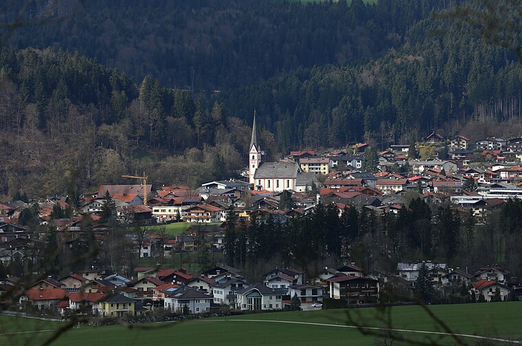
Photo: Rufus46, CC BY-SA 3.0.
Niederndorf is a municipality in the Kufstein district in the Austrian state of Tyrol located 7 km north of Kufstein and 2 km north above Ebbs near the border to Bavaria, Germany. Niederndorf is situated 3 km north of Unterrainer Transport.
Hocheck
Hamlet

Photo: Rufus46, CC BY-SA 3.0.
Hocheck is a mountain in the district of Rosenheim, Bavaria, Germany. It is closely associated with the nearby town of Oberaudorf. The mountain is about 860 metres high. Hocheck is situated 5 km northwest of Unterrainer Transport.
Unterrainer Transport
- Type: Retail building
- Address: Kleinfeld 7, Ebbs, 6341
- Category: building
- Location: Ebbs, Kufstein District, Tyrol, Austria, Central Europe, Europe
- View on OpenStreetMap
Latitude
47.62279° or 47° 37′ 22″ northLongitude
12.21092° or 12° 12′ 39″ eastOpen location code
8FVJJ6F6+49OpenStreetMap ID
way 133740187OpenStreetMap feature
building=retail
This page is based on OpenStreetMap, Wikidata, and Wikimedia Commons.
We’d love your help improving our open data sources. Thank you for contributing.
Satellite Map
Discover Unterrainer Transport from above in high-definition satellite imagery.
Notable Places Nearby
Highlights include Volleyballplatz and Skatepark.
Nearby Places
Explore places such as Kronbichler Estriche and Charly’s Bikeshop.
Tyrol: Must-Visit Destinations
Delve into Innsbruck, Kufstein, Lienz, and Kitzbühel.
Curious Retail Buildings to Discover
Uncover intriguing retail buildings from every corner of the globe.
About Mapcarta. Data © OpenStreetMap contributors and available under the Open Database License". Text is available under the CC BY-SA 4.0 license, except for photos, directions, and the map. Photo: Traveler100, CC BY-SA 3.0.