Heufert
Heufert is a farm in Heek, Borken, North Rhine-Westphalia. Heufert is situated nearby to the nature reserve Ammerter Mark, as well as near Goorbach mit Hornebecke.| Tap on a place to explore it |
Places in the Area
Nearby places include Ochtrup and Epe.
Ochtrup
Town
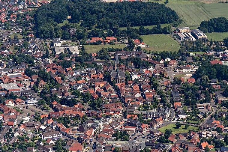
Photo: Wikimedia, CC BY-SA 4.0.
Ochtrup is a town in the district of Steinfurt, in North Rhine-Westphalia, Germany. It is situated approximately 20 km west of Rheine and 20 km east of Enschede. Ochtrup is situated 6 km northeast of Heufert.
Epe
Village
Epe is a village in the district of Borken in the state of North Rhine-Westphalia, Germany. It is located on the Dutch border, approx. 10 km east of Enschede. Epe is situated 6 km west of Heufert.
Heek
Village

Photo: Wikimedia, CC BY-SA 4.0.
Heek is a municipality in the district of Borken, in North Rhine-Westphalia, Germany. It is located near the border with the Netherlands, approx. 20 km south-east of Enschede. Heek consists of two villages, Heek and Nienborg. Heek is situated 6 km south of Heufert.
Heufert
- Type: Farm
- Category: agriculture
- Location: Heek, Borken, Münster, North Rhine-Westphalia, Germany, Central Europe, Europe
- View on OpenStreetMap
Latitude
52.18097° or 52° 10′ 52″ northLongitude
7.12197° or 7° 7′ 19″ eastOpen location code
9F4954JC+9QOpenStreetMap ID
way 133762744OpenStreetMap feature
landuse=farmyard
This page is based on OpenStreetMap, Wikidata, and Wikimedia Commons.
We’d love your help improving our open data sources. Thank you for contributing.
Satellite Map
Discover Heufert from above in high-definition satellite imagery.
Notable Places Nearby
Highlights include Ammerter Mark and FC Weiner Sparkassenpark.
Nearby Places
Explore places such as Schulte Albert and Bröker.
North Rhine-Westphalia: Must-Visit Destinations
Delve into Cologne, Düsseldorf, Bonn, and Dortmund.
Curious Farms to Discover
Uncover intriguing farms from every corner of the globe.
About Mapcarta. Data © OpenStreetMap contributors and available under the Open Database License". Text is available under the CC BY-SA 4.0 license, except for photos, directions, and the map. Photo: Daniel Schwen, CC BY-SA 2.5.