Deubitzwiesen
Deubitzwiesen is a grassland in Germany. Deubitzwiesen is situated nearby to the pond Deubitzteich, as well as near the forest Dübener Heide.| Tap on a place to explore it |
Places of Interest Nearby
Highlights include Gedenkstätte Lager Heide and Soldatengrab.
Gedenkstätte Lager Heide
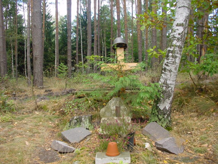
Protected area

Photo: Lutzto, CC BY-SA 3.0.
Gedenkstätte Lager Heide is a protected area, which is situated 2½ km southeast of Deubitzwiesen.
Wasserwerk Durchwehna
Building

Photo: Radler59, CC BY-SA 4.0.
Wasserwerk Durchwehna is a building, which is situated 3½ km southeast of Deubitzwiesen.
Places in the Area
Nearby places include Kossa and Bad Schmiedeberg.
Kossa
Village

Photo: Radler59, CC BY-SA 4.0.
Kossa is a village, which is situated 4½ km south of Deubitzwiesen.
Bad Schmiedeberg
Town

Photo: Medien-gbr, CC BY-SA 3.0.
Bad Schmiedeberg is a small town in the district of Wittenberg, Saxony-Anhalt, Germany. It lies within the Düben Heath Nature Park. Bad Schmiedeberg is situated 6 km northeast of Deubitzwiesen.
Hammermühle (Bad Düben)
Village

Photo: Heidebiber, CC BY-SA 4.0.
Hammermühle (Bad Düben) is a village, which is situated 8 km southwest of Deubitzwiesen.
Deubitzwiesen
- Type: Grassland
- Location: Germany, Central Europe, Europe
- View on OpenStreetMap
Latitude
51.65687° or 51° 39′ 25″ northLongitude
12.67153° or 12° 40′ 18″ eastOpen location code
9F3JMM4C+PJOpenStreetMap ID
way 1339336616OpenStreetMap feature
landuse=grass
This page is based on OpenStreetMap, Wikidata, and Wikimedia Commons.
We’d love your help improving our open data sources. Thank you for contributing.
Satellite Map
Discover Deubitzwiesen from above in high-definition satellite imagery.
Notable Places Nearby
Highlights include Deubitzteich and Dübener Heide.
Nearby Places
Explore places such as Teufelsteich and Grenzweg-Hütte.
Germany: Must-Visit Destinations
Delve into Berlin, Munich, Hamburg, and Frankfurt.
Curious Grasslands to Discover
Uncover intriguing grasslands from every corner of the globe.
About Mapcarta. Data © OpenStreetMap contributors and available under the Open Database License". Text is available under the CC BY-SA 4.0 license, except for photos, directions, and the map. Photo: Taxiarchos228, FAL.