GRgIII Hagenmüllergasse 30
GRgIII Hagenmüllergasse 30 is a school in Landstraße, Vienna which is located on Hagenmüllergasse. GRgIII Hagenmüllergasse 30 is situated nearby to the apartment building Felleis-Hof, as well as near Combatives Vienna Selbstverteidigung.| Tap on a place to explore it |
Places of Interest Nearby
Highlights include Ernst-Happel-Stadion and Rabenhof Theater.
Ernst-Happel-Stadion
Stadium

Photo: Arne mueseler, CC BY-SA 3.0 de.
Ernst-Happel-Stadion, known as Praterstadion until 1992, is a football stadium in Leopoldstadt, the 2nd district of Austria's capital Vienna. With 50,865 seats, it is the largest stadium in Austria. Ernst-Happel-Stadion is situated 1½ km northeast of GRgIII Hagenmüllergasse 30.
Rabenhof Theater
Theater building

Photo: W., CC BY-SA 3.0.
Rabenhof Theater is a theater building, which is situated 240 metres southwest of GRgIII Hagenmüllergasse 30.
Belvedere
Park
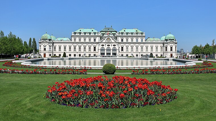
Photo: Bwag, CC BY-SA 4.0.
The Belvedere is a historic building complex in Vienna, Austria consisting of two Baroque palaces, the Orangery, and the Palace Stables. The buildings are set in a Baroque park landscape in the third district of the city, on the south-eastern edge of its centre. Belvedere is situated 2 km west of GRgIII Hagenmüllergasse 30.
Places in the Area
Nearby places include Erdberg and Pratercottage.


GRgIII Hagenmüllergasse 30
- Type: School
- Address: Hagenmüllergasse 30, Wien, 1030
- Category: education
- Location: Landstraße, Vienna, Austria, Central Europe, Europe
- View on OpenStreetMap
Latitude
48.19764° or 48° 11′ 52″ northLongitude
16.40345° or 16° 24′ 12″ eastOpen location code
8FWR5CX3+39OpenStreetMap ID
way 1340541221OpenStreetMap feature
amenity=school
This page is based on OpenStreetMap, Wikidata, and Wikimedia Commons.
We’d love your help improving our open data sources. Thank you for contributing.
Satellite Map
Discover GRgIII Hagenmüllergasse 30 from above in high-definition satellite imagery.
Notable Places Nearby
Highlights include Felleis-Hof and Combatives Vienna Selbstverteidigung.
Nearby Places
Explore places such as Hairdresser Konecny Wolfgang and Billa.
Vienna: Must-Visit Destinations
Delve into Innere Stadt, Vienna International Airport, Inner East, and Hietzing.
Curious Schools to Discover
Uncover intriguing schools from every corner of the globe.
About Mapcarta. Data © OpenStreetMap contributors and available under the Open Database License". Text is available under the CC BY-SA 4.0 license, except for photos, directions, and the map. Photo: Miguel Mendez, CC BY 2.0.