Unidade Habitacional de Santo António
Unidade Habitacional de Santo António is a social service facility in Cedofeita, Ildefonso, Sé, Miragaia, Nicolau, Vitória, Porto which is located on Rua do Barão de Forrester. Unidade Habitacional de Santo António is situated nearby to the courthouse Juízo de Família e Menores do Porto, as well as near the government office Direção Geral de Reinserção Social.| Tap on a place to explore it |
- Type: Social service facility
- Also known as: “UHSA”
- Address: Rua do Barão de Forrester
Places of Interest Nearby
Highlights include Carolina Michaëlis station and Lapa station.
Carolina Michaëlis station
Railway station
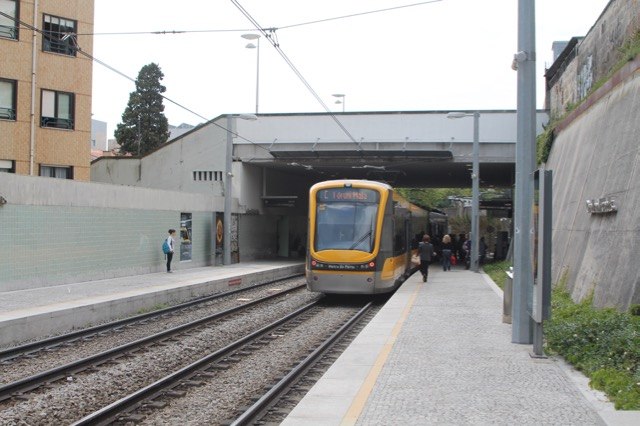
Photo: Ernstkers, CC BY-SA 4.0.
Carolina Michaëlis is a light rail station on the Porto Metro system in Porto, Portugal. The station is partly underground, beneath the Carolina Michaëlis de Vasconcelos stairway and in front of the Carolina Michaëlis Secondary School. It was opened in 2002. Carolina Michaëlis station is situated 230 metres west of Unidade Habitacional de Santo António.
Lapa station
Railway station

Photo: Ymblanter, CC BY-SA 4.0.
Lapa is a light rail station on the Porto Metro system in Porto, Portugal. It was opened in 2002. Lapa station is situated 240 metres southeast of Unidade Habitacional de Santo António.
Casa da Música

Photo: xiquinhosilva, CC BY 2.0.
The Casa da Música is a concert hall in Porto, Portugal. It was designed by architect Rem Koolhaas and opened in 2005. Designed to mark the festive year of 2001 in which the city of Porto was designated European Capital of Culture, it was the first building… Casa da Música is situated 1 km west of Unidade Habitacional de Santo António.
Places in the Area
Nearby places include Bouça Housing Complex and Cedofeita.
Bouça Housing Complex
Neighborhood

Photo: Aoamen, CC BY-SA 3.0.
Bouça Housing Complex is a neighborhood.
Cedofeita
Suburb

Photo: Aleksandr Zykov, CC BY-SA 2.0.
Cedofeita is a former civil parish in the municipality of Porto, Portugal. In 2013, the parish merged into the new parish Cedofeita, Santo Ildefonso, Sé, Miragaia, São Nicolau e Vitória.
Porto City Centre
Neighborhood

Photo: Marcello Saponaro, CC BY 2.0.
Porto City Centre is a neighborhood.
Unidade Habitacional de Santo António
Latitude
41.15834° or 41° 9′ 30″ northLongitude
-8.61915° or 8° 37′ 9″ westInception
May 19th, 2005Operator
AIMAOpen location code
8CHH595J+88OpenStreetMap ID
way 1346363701OpenStreetMap feature
amenity=social_facilityOpenStreetMap feature
landuse=residential
This page is based on OpenStreetMap, Wikidata, and Wikimedia Commons.
We’d love your help improving our open data sources. Thank you for contributing.
Satellite Map
Discover Unidade Habitacional de Santo António from above in high-definition satellite imagery.
Notable Places Nearby
Highlights include Juízo de Família e Menores do Porto and Direção Geral de Reinserção Social.
Nearby Places
Explore places such as Quinta de Santo António das Águas Férreas and Aviz lavandaria.
Portugal: Must-Visit Destinations
Delve into Lisbon, Caldas da Rainha, Coimbra, and Braga.
Curious Social Service Facilities to Discover
Uncover intriguing social service facilities from every corner of the globe.
About Mapcarta. Data © OpenStreetMap contributors and available under the Open Database License". Text is available under the CC BY-SA 4.0 license, except for photos, directions, and the map. Photo: Olegivvit, CC BY 2.5.