Am Bad e.V.
Am Bad e.V. is an allotment garden in Freital, Sächsische Schweiz-Osterzgebirge, Saxony. Am Bad e.V. is situated nearby to the sports venue Freibad ‘Zacke’, as well as near Glückauf-Grundschule.| Tap on a place to explore it |
Places of Interest Nearby
Highlights include Böhlbrunnen and Castle Thorun.
Böhlbrunnen
Historic site
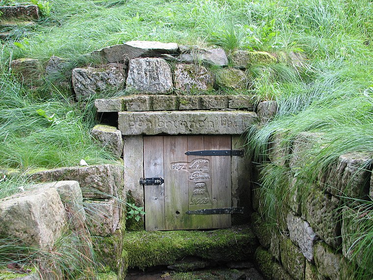
Photo: Inkowik, CC BY-SA 3.0.
Böhlbrunnen is a historic site, which is situated 1¼ km north of Am Bad e.V..
Castle Thorun
Archaeological site

Photo: Wikimedia, CC BY-SA 4.0.
Castle Thorun is an archaeological site, which is situated 1¼ km east of Am Bad e.V..
Quänebach
Forest

Photo: Inkowik, CC BY-SA 3.0.
The Quänebach is a river of Saxony, Germany. It flows into the Wiederitz in Zauckerode.
Places in the Area
Nearby places include Wurgwitz and Niederhermsdorf.
Wurgwitz
Suburb

Photo: Wikimedia, CC BY-SA 2.0.
Wurgwitz is a district of the Saxon city Freital in Sächsische Schweiz-Osterzgebirge district.


Am Bad e.V.
Latitude
51.01786° or 51° 1′ 4″ northLongitude
13.63394° or 13° 38′ 2″ eastOpen location code
9F3M2J9M+4HOpenStreetMap ID
way 135329376OpenStreetMap feature
landuse=allotments
This page is based on OpenStreetMap, Wikidata, and Wikimedia Commons.
We’d love your help improving our open data sources. Thank you for contributing.
Satellite Map
Discover Am Bad e.V. from above in high-definition satellite imagery.
Notable Places Nearby
Highlights include Freibad ‘Zacke’ and Glückauf-Grundschule.
Nearby Places
Explore places such as Zauckerode, Kindergarten and Kindergarten.
Saxon Elbland: Must-Visit Destinations
Delve into Dresden, Meißen, Riesa, and Radebeul.
Curious Allotment Gardens to Discover
Uncover intriguing allotment gardens from every corner of the globe.
About Mapcarta. Data © OpenStreetMap contributors and available under the Open Database License". Text is available under the CC BY-SA 4.0 license, except for photos, directions, and the map. Photo: Ubahnverleih, CC0.