Font de Champdamois
Font de Champdamois is a river in Quincey, Arrondissement of Vesoul, Bourgogne-Franche-Comté. Font de Champdamois is situated nearby to the village Quincey, as well as near the locality Le Petit Coret.| Tap on a place to explore it |
Places of Interest
Highlights include Sabot de Frotey National Nature Reserve and Vesoul station.
Sabot de Frotey National Nature Reserve
Nature reserve

Photo: Nerio9, CC BY-SA 3.0.
Sabot de Frotey National Nature Reserve is a national nature reserve located in Vesoul, France. It was created in 1981 over 98 hectares to protect the area from urbanisation by the nearby city of Vesoul.
Vesoul station
Railway station
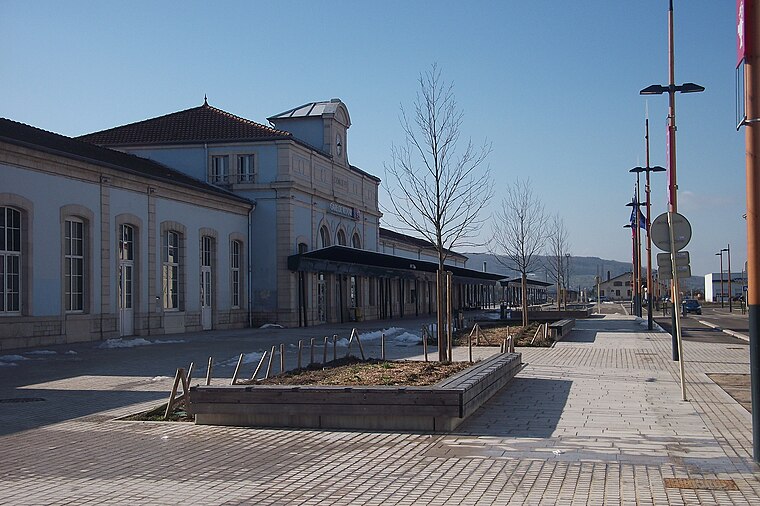
Photo: Nerio9, CC BY-SA 3.0.
Vesoul station is the railway station serving the commune of Vesoul, in the Haute-Saône department of eastern France.
Château de Colombe-lès-Vesoul
Castle

Photo: A.BourgeoisP, CC BY-SA 4.0.
Château de Colombe-lès-Vesoul is a castle.
Places in the Area
Nearby places include Vesoul and Navenne.
Vesoul

Photo: Remi Mathis, CC BY-SA 3.0.
Vesoul is a town of 15,000 people in Franche-Comté, France. Vesoul is main urban centre of the Haute-Saône department.
Navenne
Village
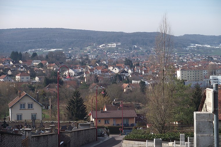
Photo: Nerio9, CC BY-SA 3.0.
Navenne is a commune in the Haute-Saône department in the region of Bourgogne-Franche-Comté in eastern France. The town is located near Vesoul.
Frotey-lès-Vesoul
Village

Photo: Nerio9, CC BY-SA 3.0.
Frotey-lès-Vesoul is a commune in the Haute-Saône department in the region of Bourgogne-Franche-Comté in eastern France. The town is located near Vesoul.
Font de Champdamois
- Type: River
- Category: body of water
- Location: Quincey, Arrondissement of Vesoul, Haute-Saône, Bourgogne-Franche-Comté, France, Europe
- View on OpenStreetMap
Latitude
47.612° or 47° 36′ 43″ northLongitude
6.1927° or 6° 11′ 34″ eastOpen location code
8FV8J56V+R3OpenStreetMap ID
way 1359961574OpenStreetMap feature
natural=waterOpenStreetMap feature
water=river
This page is based on OpenStreetMap, Wikidata, and Wikimedia Commons.
We’d love your help improving our open data sources. Thank you for contributing.
Satellite Map
Discover Font de Champdamois from above in high-definition satellite imagery.
Localities in the Area
Explore places such as Quincey and Le Petit Coret.
Notable Places Nearby
Highlights include Mairie de Quincey and Église Saint-Pierre-et-Saint-Paul de Quincey.
Bourgogne-Franche-Comté: Must-Visit Destinations
Delve into Nièvre, Dijon, Besançon, and Vesoul.
Curious Rivers to Discover
Uncover intriguing rivers from every corner of the globe.
About Mapcarta. Data © OpenStreetMap contributors and available under the Open Database License". Text is available under the CC BY-SA 4.0 license, except for photos, directions, and the map. Photo: ComputerHotline, CC BY 3.0.