Clubteich
Clubteich is a pond in Senftenberg, Oberspreewald-Lausitz, Brandenburg. Clubteich is situated nearby to the pond Neumannsteich, as well as near Germaniateich.| Tap on a place to explore it |
Places of Interest Nearby
Highlights include Hosena station and Schloss Hohenbocka.
Hosena station
Railway station

Photo: Platte, CC BY-SA 3.0.
Hosena station is a station at the junction of the Węgliniec–Roßlau railway and the Lübbenau–Kamenz railway. The station is located in the southeast of the German state of Brandenburg in the village of Hosena, north of the village of Hohenbocka. Hosena station is situated 480 metres north of Clubteich.
Schloss Hohenbocka
Castle
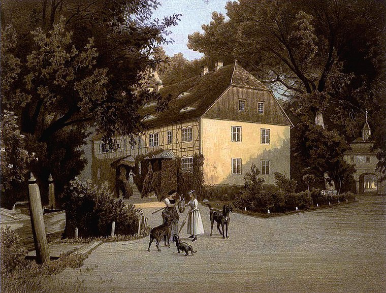
Photo: Wikimedia, Public domain.
Schloss Hohenbocka is a castle, which is situated 2 km southwest of Clubteich.
Aussichtsturm Bucksche Schweiz
Scenic viewpoint

Photo: PaulT, CC BY-SA 4.0.
Aussichtsturm Bucksche Schweiz is a scenic viewpoint, which is situated 3 km southwest of Clubteich.
Places in the Area
Nearby places include Hosena and Hohenbocka.
Hosena
Village

Photo: Hans G. Oberlack, CC BY-SA 4.0.
Hosena is a borough of the town of Senftenberg in Brandenburg, Germany. Hosena is located in Upper Lusatia not far from the Senftenberger See. Hosena station is at the junction of the Węgliniec–Roßlau railway and the Lübbenau–Kamenz railway.
Hohenbocka
Village

Photo: Z thomas, CC BY-SA 3.0.
Hohenbocka is a municipality in the Oberspreewald-Lausitz district, in Upper Lusatia, Brandenburg, Germany.
Peickwitz
Village
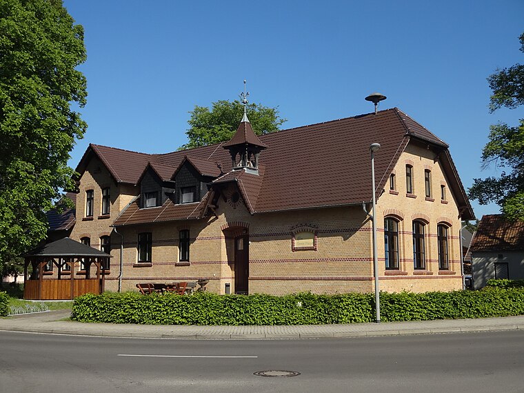
Photo: Z thomas, CC BY-SA 4.0.
Peickwitz is a village, which is situated 3 km northwest of Clubteich.
Clubteich
- Type: Pond
- Category: body of water
- Location: Senftenberg, Oberspreewald-Lausitz, Brandenburg, Germany, Central Europe, Europe
- View on OpenStreetMap
Latitude
51.45053° or 51° 27′ 2″ northLongitude
14.01453° or 14° 0′ 52″ eastOpen location code
9F3PF227+6ROpenStreetMap ID
way 136430623OpenStreetMap feature
natural=waterOpenStreetMap feature
water=pond
This page is based on OpenStreetMap, Wikidata, and Wikimedia Commons.
We’d love your help improving our open data sources. Thank you for contributing.
Satellite Map
Discover Clubteich from above in high-definition satellite imagery.
Notable Places Nearby
Highlights include Neumannsteich and Germaniateich.
Nearby Places
Explore places such as Züblin Stahlbau GmbH and Hohenbockaer Glassandwerke.
Brandenburg: Must-Visit Destinations
Delve into Potsdam, Cottbus, Frankfurt an der Oder, and Brandenburg an der Havel.
Curious Ponds to Discover
Uncover intriguing ponds from every corner of the globe.
About Mapcarta. Data © OpenStreetMap contributors and available under the Open Database License". Text is available under the CC BY-SA 4.0 license, except for photos, directions, and the map. Photo: A.Savin, CC BY-SA 3.0.