Colegio La Presentación
Colegio La Presentación is a school in Mérida, Andes. Colegio La Presentación is situated nearby to the cemetery Cementerio La Inmaculada, as well as near the church Capilla.| Tap on a place to explore it |
Places of Interest Nearby
Highlights include Alberto Carnevalli Airport and Estadio Metropolitano de Mérida.
Alberto Carnevalli Airport
Aerodrome
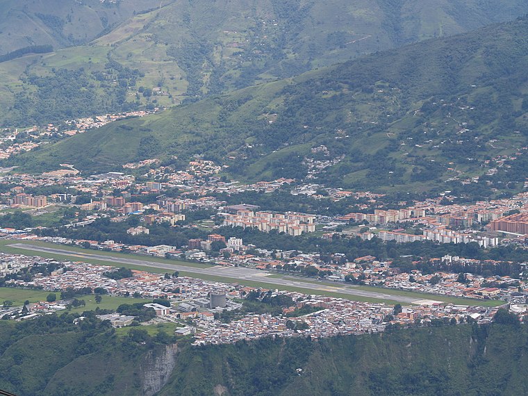
Photo: Wikimedia, Public domain.
Alberto Carnevalli Airport is an airport located 3 km southwest of downtown Mérida, the capital of Mérida State in Venezuela. It is named in honor of Alberto Carnevalli, a Venezuelan lawyer and political activist. Alberto Carnevalli Airport is situated 3 km northeast of Colegio La Presentación.
Estadio Metropolitano de Mérida
Stadium
 The Estadio Olimpico Metropolitano de Mérida or Estadio Metropolitano is a soccer stadium located in the city of Mérida in Venezuela. It was built to be one venues of the 2007 Copa América and it would also serve as one of the venues for the National Games of Venezuela Andes 2005. Estadio Metropolitano de Mérida is situated 4 km southwest of Colegio La Presentación.
Places in the Area
Nearby places include Mérida.
Mérida

Photo: venex, CC BY-SA 2.0.
Mérida the capital of Mérida State, is located in Venezuela, at the foot of the Andes, 15 kilometers from Venezuela's highest point. It is the centre for outdoor activities in Venezuela.
Colegio La Presentación
- Type: School
- Category: education
- Location: Mérida, Andes, Venezuela, South America
- View on OpenStreetMap
Latitude
8.57081° or 8° 34′ 15″ northLongitude
-71.18694° or 71° 11′ 13″ westOpen location code
67WCHRC7+86OpenStreetMap ID
way 136723887OpenStreetMap feature
amenity=school
This page is based on OpenStreetMap, Wikidata, and Wikimedia Commons.
We’d love your help improving our open data sources. Thank you for contributing.
Satellite Map
Discover Colegio La Presentación from above in high-definition satellite imagery.
Places with the Same Name
Discover other places named “Colegio La Presentación”.
Notable Places Nearby
Highlights include Cementerio La Inmaculada and Capilla.
Nearby Places
Explore places such as UAPIT and Rodamientos y Autopartes El Gato.
Mérida: Must-Visit Destinations
Delve into Mérida, Santo Domingo, and El Vigía.
Curious Places to Discover
Uncover intriguing places from every corner of the globe.
About Mapcarta. Data © OpenStreetMap contributors and available under the Open Database License". Text is available under the CC BY-SA 4.0 license, except for photos, directions, and the map. Photo: Wikimedia, CC0.