Маријино поље
Маријино поље is a building in Pančevo, South Banat District, Vojvodina which is located on Вајфертова. Маријино поље is situated nearby to the nature reserve Плавна подручја Дунава ка Винчи, as well as near Строги природни резерват „Иваново”.| Tap on a place to explore it |
Places of Interest Nearby
Highlights include Archaeological site Vinča and ОШ „Никола Тесла”.
Archaeological site Vinča
Archaeological site

Photo: WhiteWriter, CC BY-SA 3.0.
Vinča-Belo Brdo is an archaeological site in Vinča, a suburb of Belgrade, Serbia. The tell of Belo Brdo is almost entirely made up of the remains of human settlement, and was occupied several times from the Early Neolithic through to the Middle Ages. Archaeological site Vinča is situated 1¼ km southwest of Маријино поље.
ОШ „Никола Тесла”
School

Photo: Bnikolic.092, CC BY-SA 4.0.
ОШ „Никола Тесла” is a school, which is situated 4 km southwest of Маријино поље.
Places in the Area
Nearby places include Vinča and Ritopek.
Vinča
Village

Photo: .niamh., Public domain.
Vinča is a suburban settlement of Belgrade, Serbia. It is part of the municipality of Grocka. Vinča-Belo Brdo, an important archaeological site that gives its name to the Neolithic Vinča culture, is located in the village.
Ritopek
Village
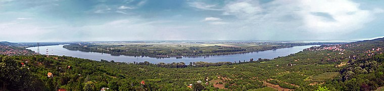
Photo: Lošmi, CC BY-SA 3.0.
Ritopek is a suburban settlement of Belgrade, Serbia. It is located in the municipality of Grocka, 20 km east of Belgrade and 19 km west of the municipal seat, on the right bank of the Danube, across from the village of Ivanovo in Banat region of the Vojvodina province. Ritopek is situated 3½ km south of Маријино поље.
Radmilovac
Hamlet

Photo: Ojce, CC BY-SA 4.0.
Radmilovac is a suburban settlement of Belgrade, the capital of Serbia, and an experimental farm of the University of Belgrade's Faculty of Agriculture. It is located in the Belgrade municipality of Grocka. It is also known for the hotel of the same name. Radmilovac is situated 4 km west of Маријино поље.
Маријино поље
- Type: Building
- Address: Вајфертова 323
- Category: pumping station
- Location: Pančevo, South Banat District, Vojvodina, Serbia, Balkans, Europe
- View on OpenStreetMap
Latitude
44.76773° or 44° 46′ 4″ northLongitude
20.63808° or 20° 38′ 17″ eastOpen location code
8GP2QJ9Q+36OpenStreetMap ID
way 1368393926OpenStreetMap feature
building=serviceOpenStreetMap feature
man_made=pumping_station
This page is based on OpenStreetMap, Wikidata, and Wikimedia Commons.
We’d love your help improving our open data sources. Thank you for contributing.
Satellite Map
Discover Маријино поље from above in high-definition satellite imagery.
In Other Languages
“Маријино поље” goes by many names.
- Serbian: “Marijino polje”
- Serbian: “Маријино поље”
Places with the Same Name
Discover other places named “Маријино поље”.
Notable Places Nearby
Highlights include Плавна подручја Дунава ка Винчи and Археолошки музеј Винча - Бело брдо.
Nearby Places
Explore places such as Vinča-Marijino polje and Брод ресторан Србија.
Vojvodina: Must-Visit Destinations
Delve into Novi Sad, Subotica, Zrenjanin, and Sremska Mitrovica.
Curious Buildings to Discover
Uncover intriguing buildings from every corner of the globe.
About Mapcarta. Data © OpenStreetMap contributors and available under the Open Database License". Text is available under the CC BY-SA 4.0 license, except for photos, directions, and the map. Photo: Wikimedia, CC0.