Spielplatz Hinter der Steige
Spielplatz Hinter der Steige is a playground in Owen, Landkreis Esslingen, Baden-Württemberg. Spielplatz Hinter der Steige is situated nearby to the church Katholisches Gemeindezentrum, as well as near the community center Evangelisches Gemeindehaus Owen.| Tap on a place to explore it |
Places of Interest Nearby
Highlights include Marienkirche and Teckberg.
Marienkirche
Church

Photo: CatalpaSpirit, CC BY-SA 4.0.
Marienkirche is a church, which is situated 500 metres northwest of Spielplatz Hinter der Steige.
Teckberg
Peak

Photo: Wikimedia, CC BY-SA 3.0.
Teckberg is a mountain located in Landkreis Esslingen, Baden-Württemberg, Germany. It stands at an elevation of 775 m above sea level and is crowned by the castle Teck.
Owen (Teck)
Railway stop

Photo: Silesia711, CC BY-SA 4.0.
Owen (Teck) is a railway stop, which is situated 710 metres northwest of Spielplatz Hinter der Steige.
Places in the Area
Nearby places include Bissingen an der Teck and Ochsenwang.
Bissingen an der Teck
Village

Photo: Iotatau, CC BY-SA 3.0.
Bissingen is a municipality in the district of Esslingen in Baden-Württemberg in southern Germany. Bissingen an der Teck is situated 3½ km northeast of Spielplatz Hinter der Steige.
Ochsenwang
Village

Photo: Franzfoto, CC BY-SA 4.0.
Ochsenwang is a village, which is situated 4 km east of Spielplatz Hinter der Steige.
Konradfels
Locality
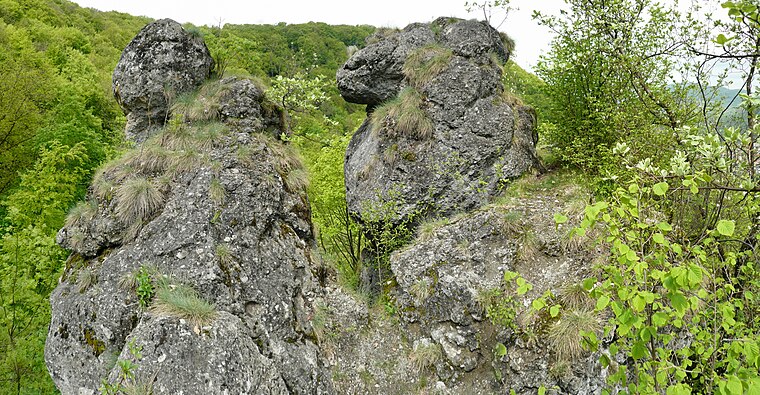
Photo: Ramessos, CC BY-SA 3.0.
Konradfels is a locality, which is situated 5 km south of Spielplatz Hinter der Steige.
Spielplatz Hinter der Steige
- Type: Playground
- Wheelchair access: yes
- Category: recreation area
- Location: Owen, Landkreis Esslingen, Stuttgart, Baden-Württemberg, Germany, Central Europe, Europe
- View on OpenStreetMap
Latitude
48.58269° or 48° 34′ 58″ northLongitude
9.45505° or 9° 27′ 18″ eastOperator
Stadt OwenOpen location code
8FWFHFM4+32OpenStreetMap ID
way 1368843136OpenStreetMap feature
leisure=playgroundOpenStreetMap attribute
wheelchair=yes
This page is based on OpenStreetMap, Wikidata, and Wikimedia Commons.
We’d love your help improving our open data sources. Thank you for contributing.
Satellite Map
Discover Spielplatz Hinter der Steige from above in high-definition satellite imagery.
Notable Places Nearby
Highlights include Katholisches Gemeindezentrum and Evangelisches Gemeindehaus Owen.
Nearby Places
Explore places such as Rebenw./ Hinter d. Steige and Owen Rebenweg.
Baden-Württemberg: Must-Visit Destinations
Delve into Stuttgart, Heidelberg, Karlsruhe, and Mannheim.
Curious Playgrounds to Discover
Uncover intriguing playgrounds from every corner of the globe.
About Mapcarta. Data © OpenStreetMap contributors and available under the Open Database License". Text is available under the CC BY-SA 4.0 license, except for photos, directions, and the map. Photo: Traveler100, CC BY-SA 3.0.