Snestruplund
Snestruplund is a house in Odense Municipality, Region of Southern Denmark. Snestruplund is situated nearby to the community center Snestrup Have, as well as near Paarup Sognegård.| Tap on a place to explore it |
Places of Interest Nearby
Highlights include Tarup Center and Paarup Church.
Tarup Center
Shopping center
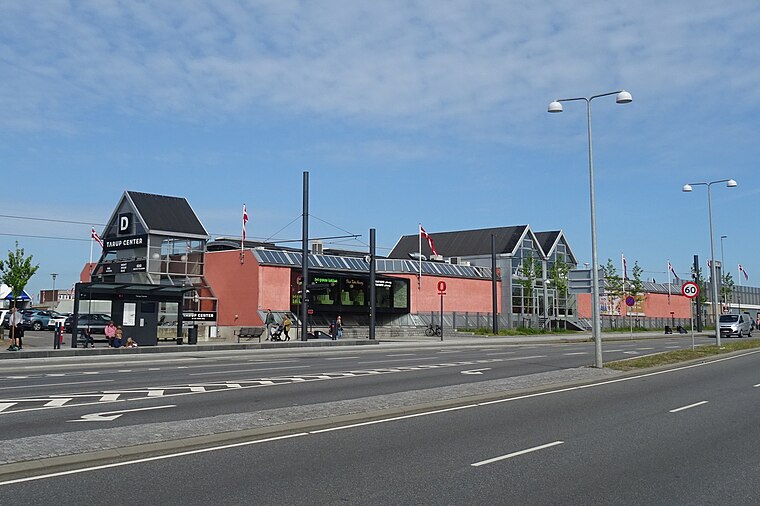
Photo: Dannebrog Spy, CC BY-SA 4.0.
Tarup Center is a shopping center, which is situated 750 metres southeast of Snestruplund.
Paarup Church
Church

Photo: ScM, CC BY-SA 3.0.
Paarup Church is situated 710 metres southwest of Snestruplund.
Snestrup
Residential area
Snestrup is a western suburb of Odense, in Funen, Denmark. Snestrup is situated 370 metres northeast of Snestruplund.
Places in the Area
Nearby places include Paarup and Tarup.
Tarup
Suburb
Tarup is a residential village and western suburb of Odense, in Funen, Denmark. It is located immediately to the northeast of Villestofte.
Villestofte
Suburb
Villestofte is a village and western suburb of Odense, in Funen, Denmark. It lies immediately to the southeast of Korup.
Snestruplund
- Type: House
- Categories: building and residential building
- Location: Odense Municipality, Region of Southern Denmark, Denmark, Nordic countries, Europe
- View on OpenStreetMap
Latitude
55.41172° or 55° 24′ 42″ northLongitude
10.32735° or 10° 19′ 39″ eastOpen location code
9F7GC86G+MWOpenStreetMap ID
way 136940466OpenStreetMap feature
building=detached
This page is based on OpenStreetMap, Wikidata, and Wikimedia Commons.
We’d love your help improving our open data sources. Thank you for contributing.
Satellite Map
Discover Snestruplund from above in high-definition satellite imagery.
Notable Places Nearby
Highlights include Snestrup Have and Paarup Sognegård.
Nearby Places
Explore places such as Tingvallagården Børnehus and MENY Rugårdsvej Slagter / Delikatesse.
Denmark: Must-Visit Destinations
Delve into Copenhagen, Aarhus, Odense, and Aalborg.
Curious Houses to Discover
Uncover intriguing houses from every corner of the globe.
About Mapcarta. Data © OpenStreetMap contributors and available under the Open Database License". Text is available under the CC BY-SA 4.0 license, except for photos, directions, and the map. Photo: Wikimedia, CC0.