Engelhardt-Automobile
Engelhardt-Automobile is a car dealership in Bremen, Germany which is located on Vegesacker Heerstraße. Engelhardt-Automobile is situated nearby to the fire station Freiwillige Feuerwehr Bremen-Schönebeck, as well as near the playground Kücksberg.| Tap on a place to explore it |
Places of Interest Nearby
Highlights include Bremen-Vegesack station and Holzkirche Schönebeck, Bremen.
Bremen-Vegesack station
Railway station
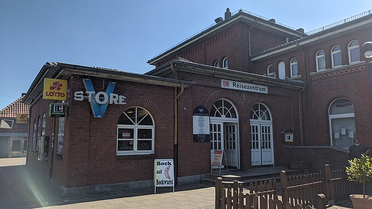
Photo: Clic, CC BY-SA 4.0.
Bremen-Vegesack is a railway station serving the Vegesack district of Bremen. The station is part of the Bremen-Farge railway line served by Bremen S-Bahn line RS1, operated by NordWestBahn. Bremen-Vegesack station is situated 780 metres southwest of Engelhardt-Automobile.
Holzkirche Schönebeck, Bremen
Church

Photo: Wilfried Willker, CC BY-SA 4.0.
Holzkirche Schönebeck, Bremen is a church, which is situated 780 metres northeast of Engelhardt-Automobile.
St. Michael (Bremen-Grohn)
Church

Photo: Joern M, CC BY-SA 3.0.
St. Michael (Bremen-Grohn) is a church, which is situated 780 metres southwest of Engelhardt-Automobile.
Places in the Area
Nearby places include Grohner Düne and Bremen-Vegesack.

Bremen-Vegesack
Suburb

Photo: Dtuk, CC BY-SA 3.0.
Vegesack is a northern district of Bremen, the capital of the German state Free Hanseatic City of Bremen.

Engelhardt-Automobile
- Type: Car dealership
- Address: Vegesacker Heerstraße 157, Bremen
- Categories: building, shop, and transportation
- Location: Bremen, City state Bremen, Germany, Central Europe, Europe
- View on OpenStreetMap
Latitude
53.17349° or 53° 10′ 25″ northLongitude
8.63994° or 8° 38′ 24″ eastOpen location code
9F5C5JFQ+9XOpenStreetMap ID
way 137716850OpenStreetMap feature
building=yesOpenStreetMap feature
shop=car
This page is based on OpenStreetMap, Wikidata, and Wikimedia Commons.
We’d love your help improving our open data sources. Thank you for contributing.
Satellite Map
Discover Engelhardt-Automobile from above in high-definition satellite imagery.
Notable Places Nearby
Highlights include Freiwillige Feuerwehr Bremen-Schönebeck and Kücksberg.
Nearby Places
Explore places such as Auf dem Krümpel and Engelhardt-Automobile.
Germany: Must-Visit Destinations
Delve into Berlin, Munich, Hamburg, and Frankfurt.
Curious Car Dealerships to Discover
Uncover intriguing car dealerships from every corner of the globe.
About Mapcarta. Data © OpenStreetMap contributors and available under the Open Database License". Text is available under the CC BY-SA 4.0 license, except for photos, directions, and the map. Photo: Dschwen, CC BY-SA 3.0.