Arya Samaj Anarkali
Arya Samaj Anarkali is a Hindu temple in Chanakya Puri, New Delhi, Delhi. Arya Samaj Anarkali is situated nearby to Mandir Marg Police Station, as well as near the police station Economic Offences Wing.| Tap on a place to explore it |
Places of Interest Nearby
Highlights include Laxminarayan Temple and Gole Market.
Laxminarayan Temple
Hindu temple
 The Laxminarayan Mandir is a Hindu temple located in New Delhi, India. The presiding deity in the temple is Laxminarayan i.e, Vishnu along with his consort Lakshmi. Laxminarayan Temple is situated 620 metres southwest of Arya Samaj Anarkali.
Gole Market
Historic building
Gole Market is a neighborhood in the heart of New Delhi, India built within a traffic roundabout by Edwin Lutyens in 1921. It is one of New Delhi's oldest surviving colonial markets and is considered an architecturally significant structure. Gole Market is situated 530 metres southeast of Arya Samaj Anarkali.
New Delhi railway station
Railway station
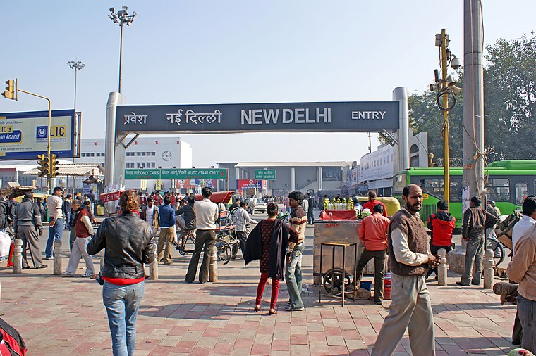
Photo: Quoique, CC BY-SA 3.0.
New Delhi railway station is the primary railway hub for the Indian capital, New Delhi, and an integral part of Indian Railways. Situated in Central Delhi, approximately 2 kilometers north of Connaught Place, the station features 16 platforms with entrances at Paharganj and Ajmeri Gate. New Delhi railway station is situated 2 km east of Arya Samaj Anarkali.
Places in the Area
Nearby places include Connaught Place and Rajendra Nagar.
Connaught Place
Suburb

Photo: Kabi1990, CC BY-SA 3.0.
Connaught Place, also known as Rajiv Chowk or CP, is one of the main financial, commercial and business centres in New Delhi, Delhi, India. It houses the headquarters of several noted Indian firms and is a major shopping, nightlife, and tourist destination in New Delhi.
Rajendra Nagar
Suburb
Rajendra Nagar is a residential colony in Central Delhi, Delhi, India. The name comes from Dr. Rajendra Prasad, the first president of India. It is bordered by the Central Ridge Protected Forest on the east and south, IARI on the west, and Karol Bagh on the north.
Eastern Delhi

Photo: Wikimedia, CC BY-SA 3.0.
Eastern Delhi consists of three administrative districts: East Delhi, North East Delhi and Shahdara, which are all on the eastern bank of the Yamuna River. Akshardham is the most famous attraction in the district.
Arya Samaj Anarkali
- Type: Hindu temple
- Also known as: “Anand Aarogya Mandir”
- Categories: place of worship and religion
- Location: Chanakya Puri, New Delhi, Delhi, Plains, India, South Asia, Asia
- View on OpenStreetMap
Latitude
28.63753° or 28° 38′ 15″ northLongitude
77.20228° or 77° 12′ 8″ eastOpen location code
7JWVJ6Q2+2WOpenStreetMap ID
way 1387018877OpenStreetMap feature
amenity=place_of_worship
This page is based on OpenStreetMap, Wikidata, and Wikimedia Commons.
We’d love your help improving our open data sources. Thank you for contributing.
Satellite Map
Discover Arya Samaj Anarkali from above in high-definition satellite imagery.
Notable Places Nearby
Highlights include Mandir Marg Police Station and Mandir Marg Police Station Complex.
Nearby Places
Explore places such as Primary Block and Doctor Meghnad Saha Science Block.
Delhi: Must-Visit Destinations
Delve into Central Delhi, Indira Gandhi International Airport, South East Delhi, and South Delhi.
Curious Hindu Temples to Discover
Uncover intriguing Hindu temples from every corner of the globe.
About Mapcarta. Data © OpenStreetMap contributors and available under the Open Database License". Text is available under the CC BY-SA 4.0 license, except for photos, directions, and the map. Photo: Wikimedia, CC0.