École des Vernets
École des Vernets is a school in Geneva, Western Switzerland. École des Vernets is situated nearby to the bridge Pont des Acacias, as well as near Hans Wilsdorf Bridge.| Tap on a place to explore it |
Places of Interest Nearby
Highlights include Musée d’ethnographie de Genève and Park Baud-Bovy.
Musée d’ethnographie de Genève
Museum
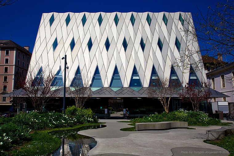
Photo: Torbjorn Toby Jorgensen, CC BY-SA 2.0.
The Musée d'ethnographie de Genève is one of the most important ethnographic museums in Switzerland. Musée d’ethnographie de Genève is situated 520 metres north of École des Vernets.
Park Baud-Bovy
Park

Photo: Alexey M., CC BY-SA 4.0.
Park Baud-Bovy is situated 260 metres northeast of École des Vernets.
Pont des Acacias
Bridge

Photo: Wikimedia, Public domain.
Pont des Acacias is a bridge, which is situated 180 metres east of École des Vernets.
Places in the Area
Nearby places include Les Acacias and Carouge.
Les Acacias
Quarter

Photo: MHM55, CC BY-SA 4.0.
Les Acacias is a district shared between the cities of Geneva and Carouge in Switzerland, located on the left bank of the Arve.

Champel
Suburb

Photo: Alexey M., CC BY-SA 4.0.
Champel is a neighborhood in the city of Geneva, Switzerland. Champel is widely considered a posh, high-class neighbourhood due to its numerous parks and natural spaces, very luxurious apartments and proximity to the city center.
École des Vernets
- Type: School
- Categories: building and education
- Location: Geneva, Geneva, Canton of Geneva, Western Switzerland, Switzerland, Central Europe, Europe
- View on OpenStreetMap
Latitude
46.1932° or 46° 11′ 36″ northLongitude
6.13706° or 6° 8′ 13″ eastLevels
2Height
11 metres (36 feet)Open location code
8FR854VP+7ROpenStreetMap ID
way 1389662665OpenStreetMap feature
amenity=schoolOpenStreetMap feature
building=yes
This page is based on OpenStreetMap, Wikidata, and Wikimedia Commons.
We’d love your help improving our open data sources. Thank you for contributing.
Satellite Map
Discover École des Vernets from above in high-definition satellite imagery.
Notable Places Nearby
Highlights include Hans Wilsdorf Bridge and Formes dans l’espace.
Nearby Places
Explore places such as Croix-Rouge genevoise and CAAP Arve - Service addictologie - Hôpitaux Universitaires de Genève.
Western Switzerland: Must-Visit Destinations
Delve into Lausanne, Lake Geneva, Fribourg, and Neuchatel.
Curious Schools to Discover
Uncover intriguing schools from every corner of the globe.
About Mapcarta. Data © OpenStreetMap contributors and available under the Open Database License". Text is available under the CC BY-SA 4.0 license, except for photos, directions, and the map. Photo: gumuz, CC BY 2.0.