Notstrom
Notstrom is a power station in Saarlouis, Saarland. Notstrom is situated nearby to the sports venue Sports & More, as well as near the government office Bundeszentralamt für Steuern, Dienstsitz Saarlouis.| Tap on a place to explore it |
Places of Interest Nearby
Highlights include Rathaus Saarlouis and Max-Planck-Gymnasium.
Rathaus Saarlouis
Town hall
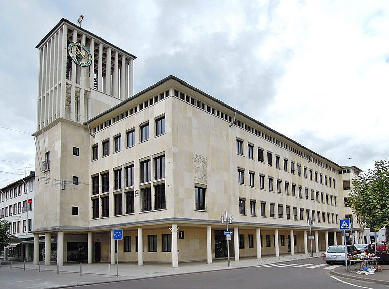
Photo: LoKiLeCh, CC BY-SA 3.0.
Rathaus Saarlouis is a town hall, which is situated 400 metres southwest of Notstrom.
Max-Planck-Gymnasium
School

Photo: Phrontis, CC BY-SA 3.0.
Max-Planck-Gymnasium is a school, which is situated 240 metres west of Notstrom.
Peter-Neis-Brücke
Bridge

Photo: FlocciNivis, CC BY-SA 4.0.
Peter-Neis-Brücke is a bridge, which is situated 260 metres north of Notstrom.
Places in the Area
Nearby places include Beaumarais and Ensdorf.

Ensdorf
Village

Photo: Lokilech, CC BY-SA 3.0.
Ensdorf is a municipality in the district of Saarlouis, in Saarland, Germany. It is on the right bank of the river Saar, opposite Saarlouis, approximately 20 km northwest of Saarbrücken. Ensdorf is situated 2½ km southeast of Notstrom.
Wallerfangen
Village

Photo: Kolling, CC BY-SA 3.0.
Wallerfangen is a municipality of Saarlouis district, Saarland, Germany. Located west of Saarlouis and along the French border, it is the seat of the villages of Ittersdorf, Ihn, Leidingen, St. Wallerfangen is situated 3 km west of Notstrom.
Notstrom
- Type: Power station
- Categories: building and industry
- Location: Saarlouis, Saarlouis, Saarland, Germany, Central Europe, Europe
- View on OpenStreetMap
Latitude
49.31863° or 49° 19′ 7″ northLongitude
6.75445° or 6° 45′ 16″ eastOperator
InexioOpen location code
8FX88Q93+FQOpenStreetMap ID
way 1389914424OpenStreetMap feature
building=yes
This page is based on OpenStreetMap, Wikidata, and Wikimedia Commons.
We’d love your help improving our open data sources. Thank you for contributing.
Satellite Map
Discover Notstrom from above in high-definition satellite imagery.
Notable Places Nearby
Highlights include Sports & More and Bundeszentralamt für Steuern, Dienstsitz Saarlouis.
Nearby Places
Explore places such as Inexio and Dr. med. Marcus Corsten.
Saarland: Must-Visit Destinations
Delve into Saarbrücken, Homburg, Merzig, and Neunkirchen.
Curious Power Stations to Discover
Uncover intriguing power stations from every corner of the globe.
About Mapcarta. Data © OpenStreetMap contributors and available under the Open Database License". Text is available under the CC BY-SA 4.0 license, except for photos, directions, and the map. Photo: wolfgangstaudt, CC BY 2.0.