Neubau der Kreuzerfeld-Sporthalle
Neubau der Kreuzerfeld-Sporthalle is in Rottenburg am Neckar, Tübingen, Baden-Württemberg. Neubau der Kreuzerfeld-Sporthalle is situated nearby to the sports venue Martha-und-Wilfried-Ensinger-Halle, as well as near the stadium Kreuzerfeld-Stadion.| Tap on a place to explore it |
Places of Interest Nearby
Highlights include Rottenburg Cathedral and Rottenburg (Neckar) station.
Rottenburg Cathedral
Church
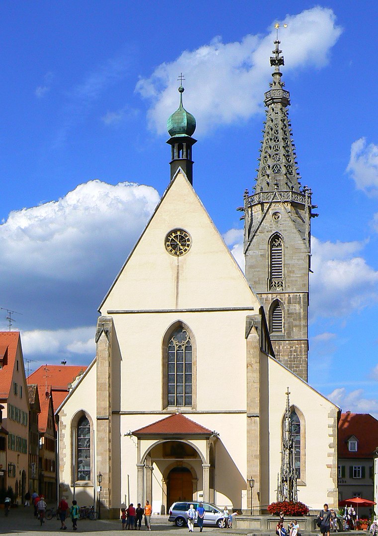
Photo: dierk schaefer, CC BY 2.0.
Rottenburg Cathedral, also known as St. Martin's Cathedral, is a Roman Catholic cathedral in Rottenburg am Neckar, Germany dedicated to Martin of Tours. It is the seat of the Diocese of Rottenburg-Stuttgart. Rottenburg Cathedral is situated 1¼ km northeast of Neubau der Kreuzerfeld-Sporthalle.
Rottenburg (Neckar) station
Railway station

Photo: Windharp, CC BY-SA 4.0.
Rottenburg (Neckar) station is a railway station, which is situated 1 km northeast of Neubau der Kreuzerfeld-Sporthalle.
St. Moriz
Church

Photo: MaiusGermanicus, Public domain.
St. Moriz is a church, which is situated 1 km northeast of Neubau der Kreuzerfeld-Sporthalle.
Places in the Area
Nearby places include Weiler and Bad Niedernau.
Weiler
Village
Weiler is a suburban district of Rottenburg am Neckar in the administrative district of Tübingen in Baden-Württemberg.
Bad Niedernau
Village
Bad Niedernau is a suburban district of Rottenburg am Neckar in the administrative district of Tübingen in Baden-Württemberg.
Dettingen
Village
Dettingen is a suburban district of Rottenburg am Neckar in the administrative district of Tübingen in Baden-Württemberg. Dettingen is situated 3½ km south of Neubau der Kreuzerfeld-Sporthalle.
Neubau der Kreuzerfeld-Sporthalle
Latitude
48.46682° or 48° 28′ 1″ northLongitude
8.92562° or 8° 55′ 32″ eastOpen location code
8FWCFW8G+P6OpenStreetMap ID
way 1391300925OpenStreetMap feature
landuse=construction
This page is based on OpenStreetMap, Wikidata, and Wikimedia Commons.
We’d love your help improving our open data sources. Thank you for contributing.
Satellite Map
Discover Neubau der Kreuzerfeld-Sporthalle from above in high-definition satellite imagery.
Notable Places Nearby
Highlights include Martha-und-Wilfried-Ensinger-Halle and Kreuzerfeld-Stadion.
Nearby Places
Explore places such as Rottenburg Kreuzerfeldschule and Rottenburg Kreuzerfeldschule.
Baden-Württemberg: Must-Visit Destinations
Delve into Stuttgart, Heidelberg, Karlsruhe, and Mannheim.
Curious Places to Discover
Uncover intriguing places from every corner of the globe.
About Mapcarta. Data © OpenStreetMap contributors and available under the Open Database License". Text is available under the CC BY-SA 4.0 license, except for photos, directions, and the map. Photo: Traveler100, CC BY-SA 3.0.