Villa Many
Villa Many is a building in Nice, Alpes-Maritimes, Provence-Alpes-Côte d’Azur. Villa Many is situated nearby to the place of worship Antoinist temple of Nice, as well as near the stadium Billetterie de l’ancien Stade du Ray.| Tap on a place to explore it |
Places of Interest Nearby
Highlights include Antoinist temple of Nice and Musée Prieuré du Vieux Logis.
Antoinist temple of Nice
Place of worship

Photo: Europe22, CC BY-SA 3.0.
Antoinist temple of Nice is a place of worship.
Musée Prieuré du Vieux Logis
Museum
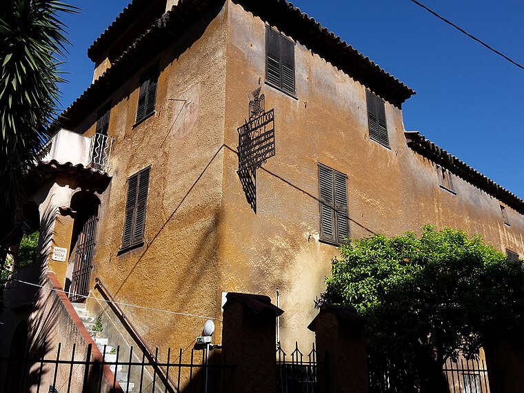
Photo: Fabimaru, CC BY-SA 4.0.
Musée Prieuré du Vieux Logis is a museum, which is situated 440 metres west of Villa Many.
Villa Arson
University
 The Villa Arson, also referred to as the École Nationale Supérieure d'Arts à la Villa Arson, is a French art museum, elite school and research institution for contemporary art, located in Nice, France. Villa Arson is situated 600 metres west of Villa Many.
Places in the Area
Nearby places include Cimiez and Saint-André-de-la-Roche.
Cimiez
Suburb
Cimiez is an upper-class neighborhood in Nice, Southern France. The area contains the Musée Matisse and the ruins of Cemenelum, capital of the Ancient Roman province Alpes Maritimae on the Ligurian coast.
Saint-André-de-la-Roche
Village

Photo: Jpchevreau, CC BY-SA 3.0.
Saint-André-de-la-Roche is a commune in the Alpes-Maritimes department in southeastern France. Until the 50s, in this small city there was a mountain with the shape of a shape-pyramid, similar to ancient pyramids from old civilizations. Saint-André-de-la-Roche is situated 3 km northeast of Villa Many.
Falicon
Village

Photo: Wikimedia, CC BY-SA 3.0.
Falicon is a commune in the Alpes-Maritimes department in southeastern France. Falicon is situated 3½ km northeast of Villa Many.
Villa Many
- Type: Building
- Location: Nice, Arrondissement of Nice, Alpes-Maritimes, Provence-Alpes-Côte d’Azur, France, Europe
- View on OpenStreetMap
Latitude
43.72135° or 43° 43′ 17″ northLongitude
7.2604° or 7° 15′ 38″ eastHeight
7 metres (23 feet)Open location code
8FM9P7C6+G5OpenStreetMap ID
way 139936062OpenStreetMap feature
building=yes
This page is based on OpenStreetMap, Wikidata, and Wikimedia Commons.
We’d love your help improving our open data sources. Thank you for contributing.
Satellite Map
Discover Villa Many from above in high-definition satellite imagery.
Notable Places Nearby
Highlights include Billetterie de l’ancien Stade du Ray and Tennis Club Méditerranée.
Nearby Places
Explore places such as Le Calypso and Le Bistronome.
Alpes-Maritimes: Must-Visit Destinations
Delve into Cannes, Antibes, Menton, and Grasse.
Curious Buildings to Discover
Uncover intriguing buildings from every corner of the globe.
About Mapcarta. Data © OpenStreetMap contributors and available under the Open Database License". Text is available under the CC BY-SA 4.0 license, except for photos, directions, and the map. Photo: Michaelphillipr, CC BY-SA 3.0.